

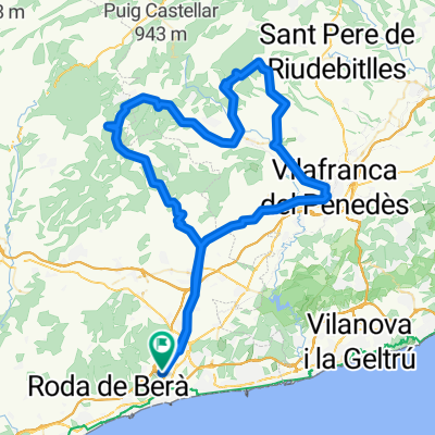
El Vendrell - Llorenç - Aiguaviva - Coll d'Arca - Maslorenç - Roda - El Vendrell
A cycling route starting in El Vendrell, Catalonia, Spain.
Overview
About this route
El Vendrell - Llorenç - Aiguaviva - Coll d'Arca - La Joncosa - Masllorenç - Bonastre - Roda de Berà - El Vendrell
Good training route for 2h 10' to 2h 30' with an elevation gain of around 900 meters over 65 kilometers. Watch out at Coll d'Arca, short but tough with a final ramp at 13%.
- -:--
- Duration
- 65.4 km
- Distance
- 726 m
- Ascent
- 726 m
- Descent
- ---
- Avg. speed
- ---
- Max. altitude

Route quality
Waytypes & surfaces along the route
Waytypes
Road
32.1 km
(49 %)
Quiet road
13.7 km
(21 %)
Surfaces
Paved
26.8 km
(41 %)
Asphalt
22.3 km
(34 %)
Paved (undefined)
4.6 km
(7 %)
Undefined
38.6 km
(59 %)
Continue with Bikemap
Use, edit, or download this cycling route
You would like to ride El Vendrell - Llorenç - Aiguaviva - Coll d'Arca - Maslorenç - Roda - El Vendrell or customize it for your own trip? Here is what you can do with this Bikemap route:
Free features
- Save this route as favorite or in collections
- Copy & plan your own version of this route
- Sync your route with Garmin or Wahoo
Premium features
Free trial for 3 days, or one-time payment. More about Bikemap Premium.
- Navigate this route on iOS & Android
- Export a GPX / KML file of this route
- Create your custom printout (try it for free)
- Download this route for offline navigation
Discover more Premium features.
Get Bikemap PremiumFrom our community
Other popular routes starting in El Vendrell
 El Vendrell – Valls – Coll de l'Illa – Montblanc – Barberà – Cabra del Camp –
- Distance
- 101.2 km
- Ascent
- 1,062 m
- Descent
- 1,055 m
- Location
- El Vendrell, Catalonia, Spain
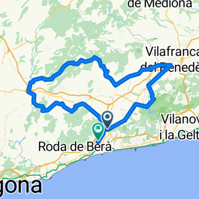
 El Vendrell - Ranxos - Font-Rubi - Vilafranca - El Vendrell
- Distance
- 102.3 km
- Ascent
- 1,015 m
- Descent
- 1,008 m
- Location
- El Vendrell, Catalonia, Spain
 El Vendrell - Llorenç - Aiguaviva - Coll d'Arca - Maslorenç - Roda - El Vendrell
- Distance
- 65.4 km
- Ascent
- 726 m
- Descent
- 726 m
- Location
- El Vendrell, Catalonia, Spain
 El Vendrell Rat Penat
- Distance
- 102.5 km
- Ascent
- 809 m
- Descent
- 809 m
- Location
- El Vendrell, Catalonia, Spain
 El Vendrell _ Panano de foix _El Vendrell
- Distance
- 47.6 km
- Ascent
- 266 m
- Descent
- 265 m
- Location
- El Vendrell, Catalonia, Spain
 la lluvia
- Distance
- 17.1 km
- Ascent
- 449 m
- Descent
- 441 m
- Location
- El Vendrell, Catalonia, Spain
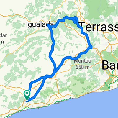 El Vendrell - Montserrat - El Vendrell
- Distance
- 170.4 km
- Ascent
- 1,215 m
- Descent
- 1,219 m
- Location
- El Vendrell, Catalonia, Spain
 Arboç-Masuques-Vilafranca-St Jaume-Aiguaviva-Vilarodona-El Vendrell
- Distance
- 93.8 km
- Ascent
- 848 m
- Descent
- 849 m
- Location
- El Vendrell, Catalonia, Spain
Open it in the app