
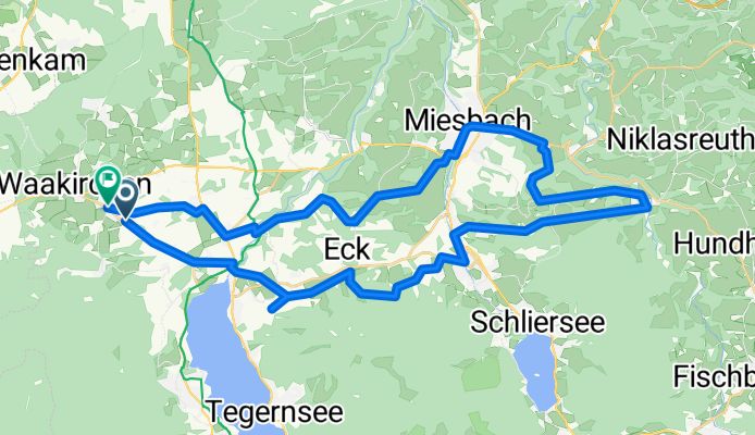
Waa_Aga_Wörn_MB_Moo_Waa
A cycling route starting in Waakirchen, Bavaria, Germany.
Overview
About this route
Weitgehend Teerstraße, das einzige Wald-Stück vor Hausham kann vermieden werden, wenn man ab Ödberg wieder weiter auf der Hauptstraße fährt. Grundsätzlich eine wunderschöne Strecke, allerdings mit vielen (z. T. langen und steilen) Steigungen.
- 2 h 44 min
- Duration
- 45.8 km
- Distance
- 848 m
- Ascent
- 839 m
- Descent
- 16.8 km/h
- Avg. speed
- 889 m
- Max. altitude

Route quality
Waytypes & surfaces along the route
Waytypes
Quiet road
26.1 km
(57 %)
Road
5.9 km
(13 %)
Surfaces
Paved
37.5 km
(82 %)
Unpaved
4.6 km
(10 %)
Asphalt
36.1 km
(79 %)
Gravel
2.3 km
(5 %)
Continue with Bikemap
Use, edit, or download this cycling route
You would like to ride Waa_Aga_Wörn_MB_Moo_Waa or customize it for your own trip? Here is what you can do with this Bikemap route:
Free features
- Save this route as favorite or in collections
- Copy & plan your own version of this route
- Sync your route with Garmin or Wahoo
Premium features
Free trial for 3 days, or one-time payment. More about Bikemap Premium.
- Navigate this route on iOS & Android
- Export a GPX / KML file of this route
- Create your custom printout (try it for free)
- Download this route for offline navigation
Discover more Premium features.
Get Bikemap PremiumFrom our community
Other popular routes starting in Waakirchen
 Lanserhof - Hainzenhöhe
- Distance
- 7.4 km
- Ascent
- 150 m
- Descent
- 148 m
- Location
- Waakirchen, Bavaria, Germany
 Von Marienstein auf den Wallberg
- Distance
- 27.7 km
- Ascent
- 761 m
- Descent
- 436 m
- Location
- Waakirchen, Bavaria, Germany
 Von Marienstein zum Tegernsee (Gut Kaltenbrunn)
- Distance
- 5.3 km
- Ascent
- 84 m
- Descent
- 148 m
- Location
- Waakirchen, Bavaria, Germany
 Kloster Reutberg Waakirchen
- Distance
- 18.8 km
- Ascent
- 110 m
- Descent
- 104 m
- Location
- Waakirchen, Bavaria, Germany
 Waa_Aga_Wörn_MB_Moo_Waa
- Distance
- 45.8 km
- Ascent
- 848 m
- Descent
- 839 m
- Location
- Waakirchen, Bavaria, Germany
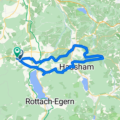
 Hauserdörfel Aueralm Hirschbachsattel Lenggries CLONED FROM ROUTE 721522
- Distance
- 47.5 km
- Ascent
- 1,189 m
- Descent
- 1,186 m
- Location
- Waakirchen, Bavaria, Germany
 Hauptstraße 32, Waakirchen nach Hauptstraße 32, Waakirchen
- Distance
- 82.8 km
- Ascent
- 908 m
- Descent
- 907 m
- Location
- Waakirchen, Bavaria, Germany
 Marienstein-Rechelkopf
- Distance
- 11.3 km
- Ascent
- 546 m
- Descent
- 546 m
- Location
- Waakirchen, Bavaria, Germany
Open it in the app