

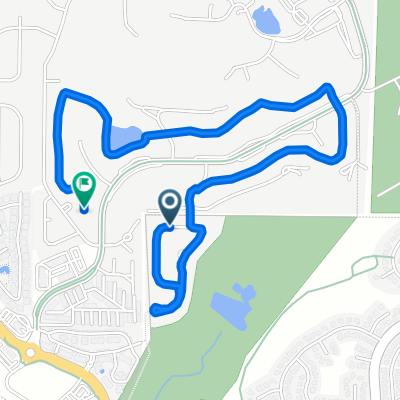
Gravel Route: Catnap Lane to Cherry Creek Path via Larkspur
A cycling route starting in Gleneagle, Colorado, United States.
Overview
About this route
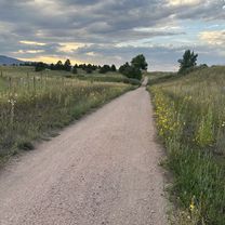
Mostly gravel
- -:--
- Duration
- 62.1 km
- Distance
- 598 m
- Ascent
- 1,022 m
- Descent
- ---
- Avg. speed
- 2,285 m
- Max. altitude

Route quality
Waytypes & surfaces along the route
Waytypes
Quiet road
29.8 km
(48 %)
Path
19.9 km
(32 %)
Surfaces
Paved
6.2 km
(10 %)
Unpaved
41.6 km
(67 %)
Ground
14.9 km
(24 %)
Gravel
12.4 km
(20 %)
Continue with Bikemap
Use, edit, or download this cycling route
You would like to ride Gravel Route: Catnap Lane to Cherry Creek Path via Larkspur or customize it for your own trip? Here is what you can do with this Bikemap route:
Free features
- Save this route as favorite or in collections
- Copy & plan your own version of this route
- Sync your route with Garmin or Wahoo
Premium features
Free trial for 3 days, or one-time payment. More about Bikemap Premium.
- Navigate this route on iOS & Android
- Export a GPX / KML file of this route
- Create your custom printout (try it for free)
- Download this route for offline navigation
Discover more Premium features.
Get Bikemap PremiumFrom our community
Other popular routes starting in Gleneagle
 Voyager/83 Loop
- Distance
- 15 km
- Ascent
- 142 m
- Descent
- 144 m
- Location
- Gleneagle, Colorado, United States
 13482 Bass Pro Dr, Colorado Springs to Struthers Rd, Colorado Springs
- Distance
- 11.4 km
- Ascent
- 140 m
- Descent
- 135 m
- Location
- Gleneagle, Colorado, United States
 Doral Way, Colorado Springs to Westchester Dr, Colorado Springs
- Distance
- 3.9 km
- Ascent
- 32 m
- Descent
- 45 m
- Location
- Gleneagle, Colorado, United States
 New Santa Fe Regional Trail, Monument to New Santa Fe Regional Trail, Monument
- Distance
- 7.8 km
- Ascent
- 50 m
- Descent
- 51 m
- Location
- Gleneagle, Colorado, United States
 baptist to woodmen
- Distance
- 17.4 km
- Ascent
- 14 m
- Descent
- 175 m
- Location
- Gleneagle, Colorado, United States
 Toscana Heights, Colorado Springs to 2167–2199 Field House Dr, Usaf Academy
- Distance
- 7.3 km
- Ascent
- 148 m
- Descent
- 71 m
- Location
- Gleneagle, Colorado, United States
 12654 Rockbridge Cir, Colorado Springs to 1183 Middle Creek Pkwy, Colorado Springs
- Distance
- 42.4 km
- Ascent
- 671 m
- Descent
- 431 m
- Location
- Gleneagle, Colorado, United States
 New Santa Fe Regional Trail, Monument to Old Denver Rd, Monument
- Distance
- 17.7 km
- Ascent
- 127 m
- Descent
- 128 m
- Location
- Gleneagle, Colorado, United States
Open it in the app