

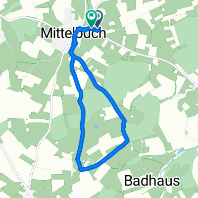
Radtour - Ringschnait-Füramoos-Ellwangen-Steinhausen-Ochsenhausen-Ringschnait
A cycling route starting in Ummendorf, Baden-Wurttemberg, Germany.
Overview
About this route
- -:--
- Duration
- 38.2 km
- Distance
- 377 m
- Ascent
- 378 m
- Descent
- ---
- Avg. speed
- 712 m
- Max. altitude

Route quality
Waytypes & surfaces along the route
Waytypes
Quiet road
15.7 km
(41 %)
Road
15.3 km
(40 %)
Surfaces
Paved
34.4 km
(90 %)
Asphalt
34.4 km
(90 %)
Undefined
3.8 km
(10 %)
Continue with Bikemap
Use, edit, or download this cycling route
You would like to ride Radtour - Ringschnait-Füramoos-Ellwangen-Steinhausen-Ochsenhausen-Ringschnait or customize it for your own trip? Here is what you can do with this Bikemap route:
Free features
- Save this route as favorite or in collections
- Copy & plan your own version of this route
- Sync your route with Garmin or Wahoo
Premium features
Free trial for 3 days, or one-time payment. More about Bikemap Premium.
- Navigate this route on iOS & Android
- Export a GPX / KML file of this route
- Create your custom printout (try it for free)
- Download this route for offline navigation
Discover more Premium features.
Get Bikemap PremiumFrom our community
Other popular routes starting in Ummendorf
 Jordanbad-Ochsenhausen-Oechsleweg
- Distance
- 41.5 km
- Ascent
- 264 m
- Descent
- 268 m
- Location
- Ummendorf, Baden-Wurttemberg, Germany
 Um den Federsee
- Distance
- 53.1 km
- Ascent
- 197 m
- Descent
- 198 m
- Location
- Ummendorf, Baden-Wurttemberg, Germany
 Oberschwaben-Runde
- Distance
- 72.4 km
- Ascent
- 490 m
- Descent
- 518 m
- Location
- Ummendorf, Baden-Wurttemberg, Germany
 Rundfahrt Öchsle
- Distance
- 44.8 km
- Ascent
- 370 m
- Descent
- 310 m
- Location
- Ummendorf, Baden-Wurttemberg, Germany
 Jordanbad- Federnsee
- Distance
- 55.1 km
- Ascent
- 205 m
- Descent
- 207 m
- Location
- Ummendorf, Baden-Wurttemberg, Germany
 Tiergarten Runde
- Distance
- 6.7 km
- Ascent
- 62 m
- Descent
- 132 m
- Location
- Ummendorf, Baden-Wurttemberg, Germany
 Süddeutsche Meisterschaft in Ummendorf 2010
- Distance
- 8.3 km
- Ascent
- 115 m
- Descent
- 113 m
- Location
- Ummendorf, Baden-Wurttemberg, Germany
 2019_7
- Distance
- 137.9 km
- Ascent
- 968 m
- Descent
- 1,191 m
- Location
- Ummendorf, Baden-Wurttemberg, Germany
Open it in the app