

Lavantalradweg-Drauradweg-Klopein
A cycling route starting in Reichenfels, Carinthia, Austria.
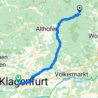
Overview
About this route
Reichenfels - Lavantalradweg - Lavamünd - Drauradweg - zum Klopeinersee
- -:--
- Duration
- 101.2 km
- Distance
- 928 m
- Ascent
- 1,266 m
- Descent
- ---
- Avg. speed
- 804 m
- Max. altitude

Route quality
Waytypes & surfaces along the route
Waytypes
Cycleway
44.6 km
(44 %)
Quiet road
25.2 km
(25 %)
Surfaces
Paved
66.8 km
(66 %)
Unpaved
0.7 km
(<1 %)
Asphalt
61.6 km
(61 %)
Paved (undefined)
5.1 km
(5 %)
Continue with Bikemap
Use, edit, or download this cycling route
You would like to ride Lavantalradweg-Drauradweg-Klopein or customize it for your own trip? Here is what you can do with this Bikemap route:
Free features
- Save this route as favorite or in collections
- Copy & plan your own version of this route
- Split it into stages to create a multi-day tour
- Sync your route with Garmin or Wahoo
Premium features
Free trial for 3 days, or one-time payment. More about Bikemap Premium.
- Navigate this route on iOS & Android
- Export a GPX / KML file of this route
- Create your custom printout (try it for free)
- Download this route for offline navigation
Discover more Premium features.
Get Bikemap PremiumFrom our community
Other popular routes starting in Reichenfels
 Klippitztörl-Klagenfurt
- Distance
- 65.1 km
- Ascent
- 233 m
- Descent
- 1,307 m
- Location
- Reichenfels, Carinthia, Austria
 Schneeeee Schuhhhh
- Distance
- 1.8 km
- Ascent
- 188 m
- Descent
- 188 m
- Location
- Reichenfels, Carinthia, Austria
 Reichenfels - Sommerau - Feldalmhütte - St.Anna - Reichenfels
- Distance
- 43.7 km
- Ascent
- 1,310 m
- Descent
- 1,309 m
- Location
- Reichenfels, Carinthia, Austria
 Lavantalradweg-Drauradweg-Klopein
- Distance
- 101.2 km
- Ascent
- 928 m
- Descent
- 1,266 m
- Location
- Reichenfels, Carinthia, Austria
 RTB8 exchanged
- Distance
- 34.5 km
- Ascent
- 1,133 m
- Descent
- 1,133 m
- Location
- Reichenfels, Carinthia, Austria
 Weissensteinhütte
- Distance
- 16.7 km
- Ascent
- 664 m
- Descent
- 634 m
- Location
- Reichenfels, Carinthia, Austria
 Reichenfels - Lavamünd
- Distance
- 55.9 km
- Ascent
- 398 m
- Descent
- 853 m
- Location
- Reichenfels, Carinthia, Austria
 St. Peter nach Leibnitz
- Distance
- 99 km
- Ascent
- 919 m
- Descent
- 1,467 m
- Location
- Reichenfels, Carinthia, Austria
Open it in the app