97 Rue Bel-Horizon, Compton à 430 Ch de Hatley, Compton
- 23.7 km
- 3,902 m
- 3,823 m
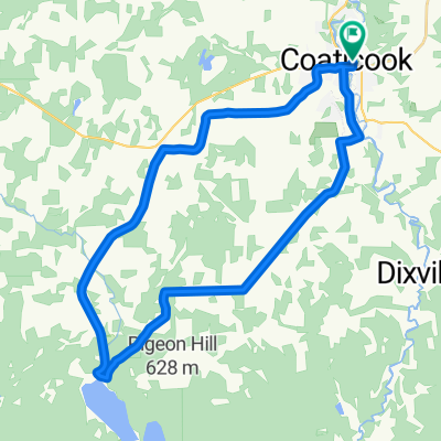
- Coaticook, Quebec, Canada
A cycling route starting in Coaticook, Quebec, Canada.
Overview
Beautiful route when you have little time to train the calves of a climber.
created this 3 years ago


Route quality
Quiet road
13.7 km
(39 %)
Road
8.1 km
(23 %)
Paved
20.7 km
(59 %)
Unpaved
13.3 km
(38 %)
Asphalt
13.3 km
(38 %)
Unpaved (undefined)
13.3 km
(38 %)
Continue with Bikemap
You would like to ride La Coaticook plein la vue! or customize it for your own trip? Here is what you can do with this Bikemap route:
Free trial for 3 days, or one-time payment. More about Bikemap Premium.
Discover more Premium features.
Get Bikemap PremiumFrom our community
Open it in the app