

HOOT BOREAL OWL - HOOT BOREAL OWL on GPSies.com
A cycling route starting in Ribnica na Pohorju, Ribnica na Pohorju, Slovenia.
Overview
About this route
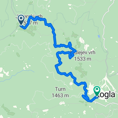
Ribnica na Pohorju-Hudi kot-Kralj-Ribniška koča-Pesnik-Ribnica na Pohorju
- -:--
- Duration
- 24.1 km
- Distance
- 1,093 m
- Ascent
- 1,096 m
- Descent
- ---
- Avg. speed
- 1,303 m
- Max. altitude

Route quality
Waytypes & surfaces along the route
Waytypes
Track
10.6 km
(44 %)
Road
7.7 km
(32 %)
Surfaces
Paved
4.8 km
(20 %)
Unpaved
17.6 km
(73 %)
Gravel
16.4 km
(68 %)
Asphalt
2.9 km
(12 %)
Continue with Bikemap
Use, edit, or download this cycling route
You would like to ride HOOT BOREAL OWL - HOOT BOREAL OWL on GPSies.com or customize it for your own trip? Here is what you can do with this Bikemap route:
Free features
- Save this route as favorite or in collections
- Copy & plan your own version of this route
- Sync your route with Garmin or Wahoo
Premium features
Free trial for 3 days, or one-time payment. More about Bikemap Premium.
- Navigate this route on iOS & Android
- Export a GPX / KML file of this route
- Create your custom printout (try it for free)
- Download this route for offline navigation
Discover more Premium features.
Get Bikemap PremiumFrom our community
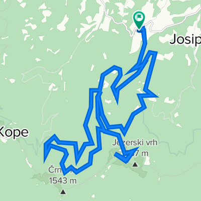
Other popular routes starting in Ribnica na Pohorju
 Hudi Kot to Rogla
- Distance
- 17.3 km
- Ascent
- 847 m
- Descent
- 888 m
- Location
- Ribnica na Pohorju, Ribnica na Pohorju, Slovenia
 Quick bike tour through Ribnica na Pohorju
- Distance
- 1.1 km
- Ascent
- 20 m
- Descent
- 25 m
- Location
- Ribnica na Pohorju, Ribnica na Pohorju, Slovenia
 Singing black grouse - Singing black grouse on GPSies.com
- Distance
- 30.5 km
- Ascent
- 1,404 m
- Descent
- 1,403 m
- Location
- Ribnica na Pohorju, Ribnica na Pohorju, Slovenia
 #blackpeak pesnik3
- Distance
- 7.4 km
- Ascent
- 309 m
- Descent
- 308 m
- Location
- Ribnica na Pohorju, Ribnica na Pohorju, Slovenia
 DEER RUN - DEER RUN on GPSies.com
- Distance
- 27.4 km
- Ascent
- 1,347 m
- Descent
- 1,350 m
- Location
- Ribnica na Pohorju, Ribnica na Pohorju, Slovenia
 Black peak reef
- Distance
- 33.9 km
- Ascent
- 1,457 m
- Descent
- 1,456 m
- Location
- Ribnica na Pohorju, Ribnica na Pohorju, Slovenia
 BAMBY - BAMBY
- Distance
- 23.7 km
- Ascent
- 1,023 m
- Descent
- 1,021 m
- Location
- Ribnica na Pohorju, Ribnica na Pohorju, Slovenia
 #blackpeak koča služnostna
- Distance
- 15.3 km
- Ascent
- 784 m
- Descent
- 784 m
- Location
- Ribnica na Pohorju, Ribnica na Pohorju, Slovenia
Open it in the app