

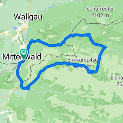
Karwendelrunde light - Mittenwald - Scharnitz - Karwendelhaus - Hinterriss - Vorderriss - Wallgau
A cycling route starting in Mittenwald, Bavaria, Germany.
Overview
About this route
Von Mittenwald führt der Radweg über Scharnitz ins Karwendeltal. Es geht ständig bergauf, das letzte Stück bis zum Karwendelhaus hat es in sich. Nach einer Rast geht es über schotterige Serpentinen hinunter zum Kleinen Ahornboden und durch das liebliche Johannistal nach Hinterriß. Auf der Mautstraße führt der Weg entlang des Rißbach nach Vorderriß über Wallgau und Krün wieder zurück.
- -:--
- Duration
- 75.5 km
- Distance
- 1,530 m
- Ascent
- 1,530 m
- Descent
- ---
- Avg. speed
- 1,793 m
- Max. altitude

Continue with Bikemap
Use, edit, or download this cycling route
You would like to ride Karwendelrunde light - Mittenwald - Scharnitz - Karwendelhaus - Hinterriss - Vorderriss - Wallgau or customize it for your own trip? Here is what you can do with this Bikemap route:
Free features
- Save this route as favorite or in collections
- Copy & plan your own version of this route
- Sync your route with Garmin or Wahoo
Premium features
Free trial for 3 days, or one-time payment. More about Bikemap Premium.
- Navigate this route on iOS & Android
- Export a GPX / KML file of this route
- Create your custom printout (try it for free)
- Download this route for offline navigation
Discover more Premium features.
Get Bikemap PremiumFrom our community
Other popular routes starting in Mittenwald
 Letzte Etappe Ulm-Gardasee-Ulm
- Distance
- 214.9 km
- Ascent
- 1,305 m
- Descent
- 1,666 m
- Location
- Mittenwald, Bavaria, Germany
 Mittenwald - Eppzirlalm - Oberbrunnalm
- Distance
- 37.7 km
- Ascent
- 927 m
- Descent
- 926 m
- Location
- Mittenwald, Bavaria, Germany
 Mittenwald-ElmauerAlm-HoherKranzberg-Arnspitzrunde
- Distance
- 70.3 km
- Ascent
- 1,142 m
- Descent
- 1,142 m
- Location
- Mittenwald, Bavaria, Germany
 Soiern-Runde
- Distance
- 48.6 km
- Ascent
- 945 m
- Descent
- 945 m
- Location
- Mittenwald, Bavaria, Germany
 Lautersee-wettersteinalm-ellmau-lautersee
- Distance
- 22.9 km
- Ascent
- 558 m
- Descent
- 558 m
- Location
- Mittenwald, Bavaria, Germany
 Karwendelrunde
- Distance
- 65 km
- Ascent
- 1,582 m
- Descent
- 1,572 m
- Location
- Mittenwald, Bavaria, Germany
 -> Ferein Alm -> Karwendelhaus
- Distance
- 67.7 km
- Ascent
- 1,579 m
- Descent
- 1,576 m
- Location
- Mittenwald, Bavaria, Germany
 Mittenwald_München
- Distance
- 115.5 km
- Ascent
- 214 m
- Descent
- 603 m
- Location
- Mittenwald, Bavaria, Germany
Open it in the app