

Hilly West Lancs
A cycling route starting in Eccleston, England, United Kingdom.
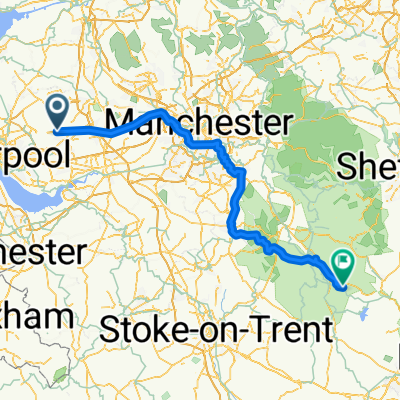
Overview
About this route
Crank Steep, Shaley, Alma, Crow, Long Heyes, Dungeon, Hillock, Stoney, Coopers, Sanderson, Hunters, Ashurst full, Tower Hill both ways.
Start up crank steep then Shaley. Head to Alma hill then do Crow ln. Come back down Mill ln then head back towards long heyes (starts on Lee's ln). Do long heyes then head down ashurst. DO Dungeon and Hillock Lanes (from Lee's lane). Head down ashurst and then go to Stoney. At top of stoney take a right then go left at robin hood then take left onto courage low ln. This leads to coopers lane (take a left) then come back up sanderson lane.Back down Coopers lane then left at bottom straight down to bentley lane then take a left up Hunters hill then descend stoney. Head up long ashurst from the skem way then go to tower hill both ways. Come down pimbo and then back to the bypass.
- -:--
- Duration
- 73.2 km
- Distance
- 1,114 m
- Ascent
- 1,115 m
- Descent
- ---
- Avg. speed
- 176 m
- Max. altitude
Route quality
Waytypes & surfaces along the route
Waytypes
Road
41.7 km
(57 %)
Quiet road
21.2 km
(29 %)
Surfaces
Paved
14.6 km
(20 %)
Asphalt
12.4 km
(17 %)
Paved (undefined)
2.2 km
(3 %)
Undefined
58.5 km
(80 %)
Continue with Bikemap
Use, edit, or download this cycling route
You would like to ride Hilly West Lancs or customize it for your own trip? Here is what you can do with this Bikemap route:
Free features
- Save this route as favorite or in collections
- Copy & plan your own version of this route
- Sync your route with Garmin or Wahoo
Premium features
Free trial for 3 days, or one-time payment. More about Bikemap Premium.
- Navigate this route on iOS & Android
- Export a GPX / KML file of this route
- Create your custom printout (try it for free)
- Download this route for offline navigation
Discover more Premium features.
Get Bikemap PremiumFrom our community
Other popular routes starting in Eccleston
 10 Mile TT route
- Distance
- 16 km
- Ascent
- 61 m
- Descent
- 52 m
- Location
- Eccleston, England, United Kingdom
 Restful route in St. Helens
- Distance
- 12.3 km
- Ascent
- 28 m
- Descent
- 63 m
- Location
- Eccleston, England, United Kingdom
 Eccleston - Wirksworth
- Distance
- 119.7 km
- Ascent
- 1,216 m
- Descent
- 941 m
- Location
- Eccleston, England, United Kingdom
 Rainford ride
- Distance
- 23 km
- Ascent
- 79 m
- Descent
- 76 m
- Location
- Eccleston, England, United Kingdom
 OFF ROAD
- Distance
- 28.3 km
- Ascent
- 117 m
- Descent
- 112 m
- Location
- Eccleston, England, United Kingdom
 Lonsdale Avenue 7 to Thorn Road 55
- Distance
- 3.6 km
- Ascent
- 53 m
- Descent
- 75 m
- Location
- Eccleston, England, United Kingdom
 Winter Ride2
- Distance
- 67.5 km
- Ascent
- 341 m
- Descent
- 341 m
- Location
- Eccleston, England, United Kingdom
 1 Regents Road, St. Helens to 1 Regents Road, St. Helens
- Distance
- 16.5 km
- Ascent
- 115 m
- Descent
- 117 m
- Location
- Eccleston, England, United Kingdom
Open it in the app