
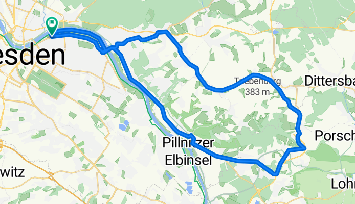
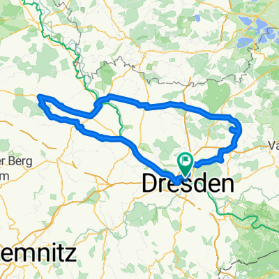
Schöne Sonnenrunde Dresden-Schönfelder Hochland-Graupa-Pillnitz-Dresden
A cycling route starting in Dresden, Saxony, Germany.
Overview
About this route
Diese Tour ist für jeden sonnigne Tag zu empfehlen. Der Radweg zwischen Schönfeld und Wünschendorf ist meist menschenleer. Ansonsten führt die Tour durch kleine verschlafene Nester des Schönfelder Hochlandes und mit dem Rückweg über Pillnitz ein besonderes Schmankerl.
- -:--
- Duration
- 39 km
- Distance
- 350 m
- Ascent
- 346 m
- Descent
- ---
- Avg. speed
- 309 m
- Max. altitude
Route quality
Waytypes & surfaces along the route
Waytypes
Busy road
13.4 km
(34 %)
Path
9.3 km
(24 %)
Surfaces
Paved
35.4 km
(91 %)
Unpaved
0.1 km
(<1 %)
Asphalt
34.8 km
(89 %)
Paving stones
0.4 km
(1 %)
Continue with Bikemap
Use, edit, or download this cycling route
You would like to ride Schöne Sonnenrunde Dresden-Schönfelder Hochland-Graupa-Pillnitz-Dresden or customize it for your own trip? Here is what you can do with this Bikemap route:
Free features
- Save this route as favorite or in collections
- Copy & plan your own version of this route
- Sync your route with Garmin or Wahoo
Premium features
Free trial for 3 days, or one-time payment. More about Bikemap Premium.
- Navigate this route on iOS & Android
- Export a GPX / KML file of this route
- Create your custom printout (try it for free)
- Download this route for offline navigation
Discover more Premium features.
Get Bikemap PremiumFrom our community
Other popular routes starting in Dresden
 Pre Velorace Trainingsausfahrt 2015 Einsteiger
- Distance
- 44.6 km
- Ascent
- 222 m
- Descent
- 222 m
- Location
- Dresden, Saxony, Germany
 Schmorsdorfer Höhenrunde
- Distance
- 49.8 km
- Ascent
- 510 m
- Descent
- 488 m
- Location
- Dresden, Saxony, Germany
 Dresden - Stolpen -Rathen
- Distance
- 54 km
- Ascent
- 447 m
- Descent
- 446 m
- Location
- Dresden, Saxony, Germany
 Dresden - Glashütte - Bahratal
- Distance
- 90.4 km
- Ascent
- 1,112 m
- Descent
- 1,142 m
- Location
- Dresden, Saxony, Germany
 Dresden - Prag
- Distance
- 217.2 km
- Ascent
- 388 m
- Descent
- 303 m
- Location
- Dresden, Saxony, Germany
 DD-Collm-Riesa-Keulenberg-DD
- Distance
- 196.8 km
- Ascent
- 1,000 m
- Descent
- 904 m
- Location
- Dresden, Saxony, Germany
 Ponickau
- Distance
- 122.5 km
- Ascent
- 320 m
- Descent
- 323 m
- Location
- Dresden, Saxony, Germany
 cielab.org - Dresden - Bahratal - Mückentürmchen
- Distance
- 130 km
- Ascent
- 1,524 m
- Descent
- 1,516 m
- Location
- Dresden, Saxony, Germany
Open it in the app