

Wentzville to New Melle
A cycling route starting in Wentzville, Missouri, United States.
Overview
About this route
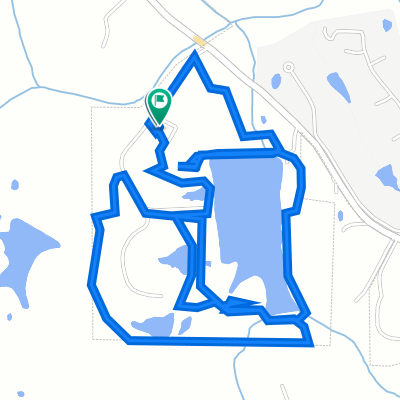
Bike from Quail Ridge Park to New Melle, and then back
- -:--
- Duration
- 45.7 km
- Distance
- 463 m
- Ascent
- 465 m
- Descent
- ---
- Avg. speed
- 242 m
- Max. altitude

Route quality
Waytypes & surfaces along the route
Waytypes
Quiet road
25.6 km
(56 %)
Road
8.2 km
(18 %)
Surfaces
Paved
7.3 km
(16 %)
Paved (undefined)
6.4 km
(14 %)
Asphalt
0.9 km
(2 %)
Undefined
38.4 km
(84 %)
Continue with Bikemap
Use, edit, or download this cycling route
You would like to ride Wentzville to New Melle or customize it for your own trip? Here is what you can do with this Bikemap route:
Free features
- Save this route as favorite or in collections
- Copy & plan your own version of this route
- Sync your route with Garmin or Wahoo
Premium features
Free trial for 3 days, or one-time payment. More about Bikemap Premium.
- Navigate this route on iOS & Android
- Export a GPX / KML file of this route
- Create your custom printout (try it for free)
- Download this route for offline navigation
Discover more Premium features.
Get Bikemap PremiumFrom our community
Other popular routes starting in Wentzville
 Wentzville route
- Distance
- 14.6 km
- Ascent
- 125 m
- Descent
- 123 m
- Location
- Wentzville, Missouri, United States
 Wentzville to New Melle
- Distance
- 45.7 km
- Ascent
- 463 m
- Descent
- 465 m
- Location
- Wentzville, Missouri, United States
 460 Peruque Hills Pkwy, Wentzville to 337 Pecan Bluffs Dr, Wentzville
- Distance
- 9.6 km
- Ascent
- 71 m
- Descent
- 76 m
- Location
- Wentzville, Missouri, United States
 Lost Lake Dr, New Melle to Lost Lake Dr, New Melle
- Distance
- 6.1 km
- Ascent
- 115 m
- Descent
- 118 m
- Location
- Wentzville, Missouri, United States
 Long ride through St. Louis
- Distance
- 108.9 km
- Ascent
- 254 m
- Descent
- 290 m
- Location
- Wentzville, Missouri, United States
 The loop
- Distance
- 50.1 km
- Ascent
- 277 m
- Descent
- 277 m
- Location
- Wentzville, Missouri, United States
 100 Bluestem Way, Wentzville to 100 Bluestem Way, Wentzville
- Distance
- 10.6 km
- Ascent
- 109 m
- Descent
- 108 m
- Location
- Wentzville, Missouri, United States
 10 Bear Fountain Ct, Wentzville to 12 Bear Fountain Ct, Wentzville
- Distance
- 17.7 km
- Ascent
- 166 m
- Descent
- 166 m
- Location
- Wentzville, Missouri, United States
Open it in the app