Nette Runde
A cycling route starting in Haigerloch, Baden-Wurttemberg, Germany.
Overview
About this route
- Route course:
-
Initially asphalt then gravel through the forest and from Binsdorf back to all asphalt* Why do you recommend it?:
-
Very pleasant for an evening ride* What are the highlights?:
-
In my opinion, unfortunately, there are none
- -:--
- Duration
- 22.4 km
- Distance
- 254 m
- Ascent
- 251 m
- Descent
- ---
- Avg. speed
- ---
- Max. altitude
Route quality
Waytypes & surfaces along the route
Waytypes
Track
8.1 km
(36 %)
Road
3.6 km
(16 %)
Surfaces
Paved
9.4 km
(42 %)
Unpaved
3.8 km
(17 %)
Asphalt
8.1 km
(36 %)
Gravel
3.8 km
(17 %)
Continue with Bikemap
Use, edit, or download this cycling route
You would like to ride Nette Runde or customize it for your own trip? Here is what you can do with this Bikemap route:
Free features
- Save this route as favorite or in collections
- Copy & plan your own version of this route
- Sync your route with Garmin or Wahoo
Premium features
Free trial for 3 days, or one-time payment. More about Bikemap Premium.
- Navigate this route on iOS & Android
- Export a GPX / KML file of this route
- Create your custom printout (try it for free)
- Download this route for offline navigation
Discover more Premium features.
Get Bikemap PremiumFrom our community
Other popular routes starting in Haigerloch
An Eyach und Neckar - Kilometer spulen- Distance
- 84.3 km
- Ascent
- 574 m
- Descent
- 575 m
- Location
- Haigerloch, Baden-Wurttemberg, Germany
Erlaheim1- Distance
- 20.1 km
- Ascent
- 157 m
- Descent
- 157 m
- Location
- Haigerloch, Baden-Wurttemberg, Germany
Kleine Abendrunde Haigerloch- Distance
- 25.2 km
- Ascent
- 214 m
- Descent
- 226 m
- Location
- Haigerloch, Baden-Wurttemberg, Germany
Rund um Gruol- Distance
- 20 km
- Ascent
- 371 m
- Descent
- 371 m
- Location
- Haigerloch, Baden-Wurttemberg, Germany
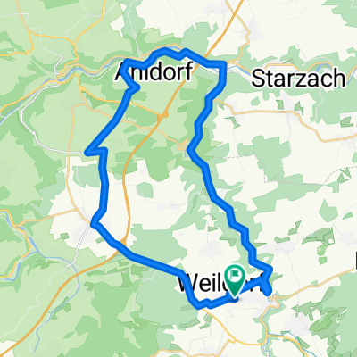
Leicht und Schwere Rundfahrt- Distance
- 24.4 km
- Ascent
- 314 m
- Descent
- 311 m
- Location
- Haigerloch, Baden-Wurttemberg, Germany
Haigerloch - Horb - Sulz - Haigerloch- Distance
- 59.5 km
- Ascent
- 401 m
- Descent
- 401 m
- Location
- Haigerloch, Baden-Wurttemberg, Germany
Haigerloch-Eyach-Rottenburg-Weiler-Hirrlingen-Haigerloch- Distance
- 52.5 km
- Ascent
- 422 m
- Descent
- 418 m
- Location
- Haigerloch, Baden-Wurttemberg, Germany
Trillfingen - Bodelshausen - Trillfingen- Distance
- 38.3 km
- Ascent
- 504 m
- Descent
- 579 m
- Location
- Haigerloch, Baden-Wurttemberg, Germany
Open it in the app

