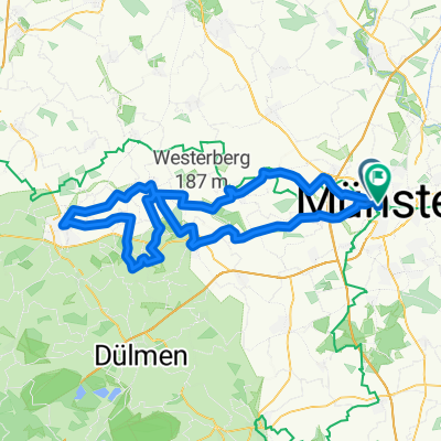
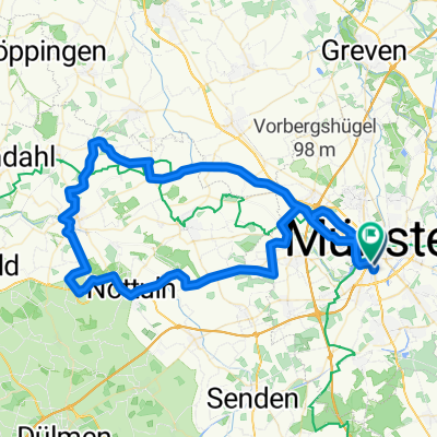
Münster - Recklinghausen
A cycling route starting in Münster, North Rhine-Westphalia, Germany.
Overview
About this route
Am Kanal bis nach Seppenrade, dann über Ahsen und Oer Erkenschwick nach Recklinghausen!
- -:--
- Duration
- 61.2 km
- Distance
- 151 m
- Ascent
- 139 m
- Descent
- ---
- Avg. speed
- ---
- Max. altitude
Route quality
Waytypes & surfaces along the route
Waytypes
Quiet road
18.6 km
(30 %)
Track
18.5 km
(30 %)
Surfaces
Paved
27.5 km
(45 %)
Unpaved
26.6 km
(44 %)
Asphalt
22.2 km
(36 %)
Gravel
19.2 km
(31 %)
Continue with Bikemap
Use, edit, or download this cycling route
You would like to ride Münster - Recklinghausen or customize it for your own trip? Here is what you can do with this Bikemap route:
Free features
- Save this route as favorite or in collections
- Copy & plan your own version of this route
- Sync your route with Garmin or Wahoo
Premium features
Free trial for 3 days, or one-time payment. More about Bikemap Premium.
- Navigate this route on iOS & Android
- Export a GPX / KML file of this route
- Create your custom printout (try it for free)
- Download this route for offline navigation
Discover more Premium features.
Get Bikemap PremiumFrom our community
Other popular routes starting in Münster
- Kurze Münsterlandrunde
- Distance
- 38.7 km
- Ascent
- 109 m
- Descent
- 109 m
- Location
- Münster, North Rhine-Westphalia, Germany
- Giro 2010 55km
- Distance
- 56 km
- Ascent
- 238 m
- Descent
- 242 m
- Location
- Münster, North Rhine-Westphalia, Germany
- Campingplatz - Emsauen- u. Kanal-Tour
- Distance
- 53.2 km
- Ascent
- 182 m
- Descent
- 179 m
- Location
- Münster, North Rhine-Westphalia, Germany
- MS 01
- Distance
- 35.9 km
- Ascent
- 48 m
- Descent
- 46 m
- Location
- Münster, North Rhine-Westphalia, Germany
- Hohe Ward Rundweg
- Distance
- 36.9 km
- Ascent
- 49 m
- Descent
- 48 m
- Location
- Münster, North Rhine-Westphalia, Germany
- MS-Rieselfelder-Telgte-MS
- Distance
- 52 km
- Ascent
- 99 m
- Descent
- 99 m
- Location
- Münster, North Rhine-Westphalia, Germany
- Baumbergekurztrip
- Distance
- 54.4 km
- Ascent
- 207 m
- Descent
- 208 m
- Location
- Münster, North Rhine-Westphalia, Germany
- Samstagnachmittagsrunde: 117 km Teuto/Schafberg
- Distance
- 117.5 km
- Ascent
- 635 m
- Descent
- 651 m
- Location
- Münster, North Rhine-Westphalia, Germany
Open it in the app