

Dußlingen und die Nachbarorte
A cycling route starting in Dußlingen, Baden-Württemberg, Germany.
Overview
About this route
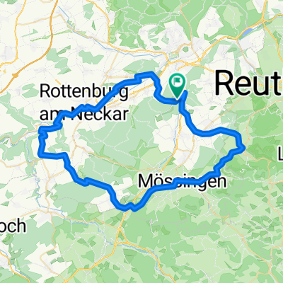
Fast ausschließlich Asphalt strecke (Fahrradwege) Durch das Sägewerk in Ofterdingen Schotter.
Falls Sie mit dem Rennrad unterwegs sind, biegen Sie nach dem Sportheim Nehren nicht links auf den Schotterweg sondern halten sich rechts hier bleibt der Untergrund Asphalt.
Bei dieser Tour lernen Sie Dußlingen, Ofterdingen, Mössingen, Nehren und Gomaringen kennen.
Für diese Strecke braucht man nicht unbedingt viel Konditon.
- -:--
- Duration
- 24.9 km
- Distance
- 134 m
- Ascent
- 136 m
- Descent
- ---
- Avg. speed
- ---
- Max. altitude
Continue with Bikemap
Use, edit, or download this cycling route
You would like to ride Dußlingen und die Nachbarorte or customize it for your own trip? Here is what you can do with this Bikemap route:
Free features
- Save this route as favorite or in collections
- Copy & plan your own version of this route
- Sync your route with Garmin or Wahoo
Premium features
Free trial for 3 days, or one-time payment. More about Bikemap Premium.
- Navigate this route on iOS & Android
- Export a GPX / KML file of this route
- Create your custom printout (try it for free)
- Download this route for offline navigation
Discover more Premium features.
Get Bikemap PremiumFrom our community
Other popular routes starting in Dußlingen
 Dußlingen_Dreifürstenstein_47km_1100Hm
- Distance
- 48.4 km
- Ascent
- 767 m
- Descent
- 767 m
- Location
- Dußlingen, Baden-Württemberg, Germany
 Dußlingen und die Nachbarorte
- Distance
- 24.9 km
- Ascent
- 134 m
- Descent
- 136 m
- Location
- Dußlingen, Baden-Württemberg, Germany
 Spitzberg
- Distance
- 18.2 km
- Ascent
- 725 m
- Descent
- 723 m
- Location
- Dußlingen, Baden-Württemberg, Germany
 Trainingsrunde Alb (Talheimer Steige)
- Distance
- 74 km
- Ascent
- 799 m
- Descent
- 784 m
- Location
- Dußlingen, Baden-Württemberg, Germany
 Dußlingen, Betzingen, Tübingen, Dußlingen
- Distance
- 31 km
- Ascent
- 185 m
- Descent
- 185 m
- Location
- Dußlingen, Baden-Württemberg, Germany
 Glatt Schloßcafe
- Distance
- 91.1 km
- Ascent
- 1,642 m
- Descent
- 1,645 m
- Location
- Dußlingen, Baden-Württemberg, Germany
 Training 1.5.'08
- Distance
- 57.9 km
- Ascent
- 432 m
- Descent
- 430 m
- Location
- Dußlingen, Baden-Württemberg, Germany
 Trainingsrunde durch den südlichen Kreis Tübingen
- Distance
- 62.2 km
- Ascent
- 471 m
- Descent
- 559 m
- Location
- Dußlingen, Baden-Württemberg, Germany
Open it in the app