

Moravská cyklocesta - Južná časť
A cycling route starting in Lanžhot, South Moravian, Czechia.
Overview
About this route
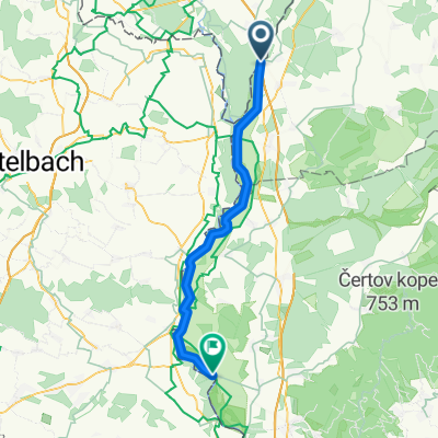
The route starts at the Brodské bridge (where it connects with the northern part), initially running along a pervious flood levee, later on an old signal - an asphalt road (now damaged in some places) that served the border guard. Along the way, in addition to the relatively well-preserved nature, one can spot fortifications built in the 1930s to protect the border, as well as remnants of the 'iron curtain' also built for border protection. I believe the route can be extended up to Devín, but I am not familiar with the section from Vysoká to D.N.Ves, so I would welcome a 'comment' for further detail.
- -:--
- Duration
- 47.9 km
- Distance
- 13 m
- Ascent
- 17 m
- Descent
- ---
- Avg. speed
- 156 m
- Max. altitude
Route quality
Waytypes & surfaces along the route
Waytypes
Track
37.3 km
(78 %)
Access road
9.1 km
(19 %)
Surfaces
Paved
12.9 km
(27 %)
Unpaved
32.1 km
(67 %)
Gravel
27.3 km
(57 %)
Asphalt
12.9 km
(27 %)
Continue with Bikemap
Use, edit, or download this cycling route
You would like to ride Moravská cyklocesta - Južná časť or customize it for your own trip? Here is what you can do with this Bikemap route:
Free features
- Save this route as favorite or in collections
- Copy & plan your own version of this route
- Sync your route with Garmin or Wahoo
Premium features
Free trial for 3 days, or one-time payment. More about Bikemap Premium.
- Navigate this route on iOS & Android
- Export a GPX / KML file of this route
- Create your custom printout (try it for free)
- Download this route for offline navigation
Discover more Premium features.
Get Bikemap PremiumFrom our community
Other popular routes starting in Lanžhot
 SK-CZ-AT
- Distance
- 11.1 km
- Ascent
- 129 m
- Descent
- 128 m
- Location
- Lanžhot, South Moravian, Czechia
 Soutok tour
- Distance
- 32.9 km
- Ascent
- 71 m
- Descent
- 70 m
- Location
- Lanžhot, South Moravian, Czechia
 Moravská cyklocesta - Južná časť
- Distance
- 47.9 km
- Ascent
- 13 m
- Descent
- 17 m
- Location
- Lanžhot, South Moravian, Czechia
 Kolem ČR 5.
- Distance
- 327.3 km
- Ascent
- 3,585 m
- Descent
- 3,162 m
- Location
- Lanžhot, South Moravian, Czechia
 Day 7 Lanžhot to Stupava
- Distance
- 77.8 km
- Ascent
- 65 m
- Descent
- 56 m
- Location
- Lanžhot, South Moravian, Czechia
 K trojštátiu, Sekule do Štúrova 21, Brodské
- Distance
- 15.9 km
- Ascent
- 165 m
- Descent
- 165 m
- Location
- Lanžhot, South Moravian, Czechia
 NJKČR - 2. etapa
- Distance
- 76.5 km
- Ascent
- 263 m
- Descent
- 111 m
- Location
- Lanžhot, South Moravian, Czechia
 Lehká ,rovinnatá trasa Lanžhot-Buková
- Distance
- 53.5 km
- Ascent
- 378 m
- Descent
- 220 m
- Location
- Lanžhot, South Moravian, Czechia
Open it in the app