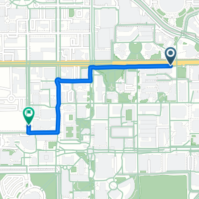
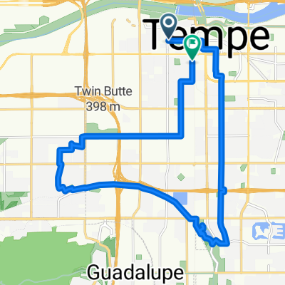
Tempe lake route 1
A cycling route starting in Tempe Junction, Arizona, United States of America.
Overview
About this route
- -:--
- Duration
- 6.8 km
- Distance
- 69 m
- Ascent
- 67 m
- Descent
- ---
- Avg. speed
- 358 m
- Max. altitude
Route quality
Waytypes & surfaces along the route
Waytypes
Cycleway
6.2 km
(91 %)
Path
0.2 km
(3 %)
Surfaces
Paved
6.3 km
(92 %)
Concrete
5.8 km
(85 %)
Asphalt
0.5 km
(7 %)
Undefined
0.5 km
(8 %)
Continue with Bikemap
Use, edit, or download this cycling route
You would like to ride Tempe lake route 1 or customize it for your own trip? Here is what you can do with this Bikemap route:
Free features
- Save this route as favorite or in collections
- Copy & plan your own version of this route
- Sync your route with Garmin or Wahoo
Premium features
Free trial for 3 days, or one-time payment. More about Bikemap Premium.
- Navigate this route on iOS & Android
- Export a GPX / KML file of this route
- Create your custom printout (try it for free)
- Download this route for offline navigation
Discover more Premium features.
Get Bikemap PremiumFrom our community
Other popular routes starting in Tempe Junction
- Tempe ASU to Home
- Distance
- 21.4 km
- Ascent
- 84 m
- Descent
- 12 m
- Location
- Tempe Junction, Arizona, United States of America
- South Potato
- Distance
- 82.6 km
- Ascent
- 316 m
- Descent
- 316 m
- Location
- Tempe Junction, Arizona, United States of America
- tempe-scottsdale-camelback
- Distance
- 49.1 km
- Ascent
- 110 m
- Descent
- 113 m
- Location
- Tempe Junction, Arizona, United States of America
- Best of Papago, Mild
- Distance
- 18.4 km
- Ascent
- 176 m
- Descent
- 177 m
- Location
- Tempe Junction, Arizona, United States of America
- Tempe lake route 1
- Distance
- 6.8 km
- Ascent
- 69 m
- Descent
- 67 m
- Location
- Tempe Junction, Arizona, United States of America
- Mesa Half Metric
- Distance
- 50 km
- Ascent
- 271 m
- Descent
- 271 m
- Location
- Tempe Junction, Arizona, United States of America
- Alameda Bridge NW loop
- Distance
- 21.9 km
- Ascent
- 128 m
- Descent
- 127 m
- Location
- Tempe Junction, Arizona, United States of America
- East Rio Salado Parkway 60, Tempe to East Rio Salado Parkway 68E, Tempe
- Distance
- 13 km
- Ascent
- 193 m
- Descent
- 226 m
- Location
- Tempe Junction, Arizona, United States of America
Open it in the app