
East 131st Street 9090, Fishers to East 131st Street 9090, Fishers
A cycling route starting in Fishers, Indiana, United States.
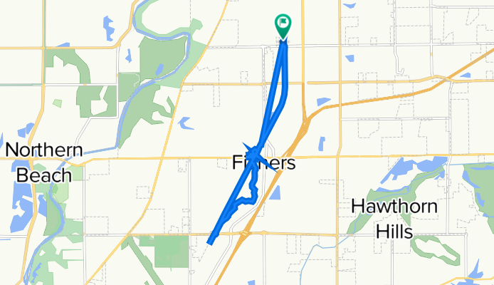
Overview
About this route
- 2 h
- Duration
- 11.8 km
- Distance
- 26 m
- Ascent
- 23 m
- Descent
- 5.9 km/h
- Avg. speed
- 258 m
- Max. altitude

Route photos


Continue with Bikemap
Use, edit, or download this cycling route
You would like to ride East 131st Street 9090, Fishers to East 131st Street 9090, Fishers or customize it for your own trip? Here is what you can do with this Bikemap route:
Free features
- Save this route as favorite or in collections
- Copy & plan your own version of this route
- Sync your route with Garmin or Wahoo
Premium features
Free trial for 3 days, or one-time payment. More about Bikemap Premium.
- Navigate this route on iOS & Android
- Export a GPX / KML file of this route
- Create your custom printout (try it for free)
- Download this route for offline navigation
Discover more Premium features.
Get Bikemap PremiumFrom our community
Other popular routes starting in Fishers
 5351 E 96th St, Indianapolis to 5429 E 96th St, Indianapolis
- Distance
- 9.3 km
- Ascent
- 213 m
- Descent
- 226 m
- Location
- Fishers, Indiana, United States
 8617 Allisonville Rd, Indianapolis to 10110 Brooks School Rd, Fishers
- Distance
- 14.4 km
- Ascent
- 52 m
- Descent
- 37 m
- Location
- Fishers, Indiana, United States
 5405 Alvamar Pl, Carmel to 2201–2277 W Riverside Ave, Muncie
- Distance
- 73.7 km
- Ascent
- 160 m
- Descent
- 97 m
- Location
- Fishers, Indiana, United States
 40 mile East of Lapel route
- Distance
- 65.4 km
- Ascent
- 52 m
- Descent
- 47 m
- Location
- Fishers, Indiana, United States
 Boggstown
- Distance
- 139 km
- Ascent
- 81 m
- Descent
- 82 m
- Location
- Fishers, Indiana, United States
 Fishers Route
- Distance
- 10.4 km
- Ascent
- 0 m
- Descent
- 0 m
- Location
- Fishers, Indiana, United States
 East 131st Street 9090, Fishers to East 131st Street 9090, Fishers
- Distance
- 11.8 km
- Ascent
- 26 m
- Descent
- 23 m
- Location
- Fishers, Indiana, United States
 34 mile Strawtown route
- Distance
- 54.8 km
- Ascent
- 52 m
- Descent
- 50 m
- Location
- Fishers, Indiana, United States
Open it in the app