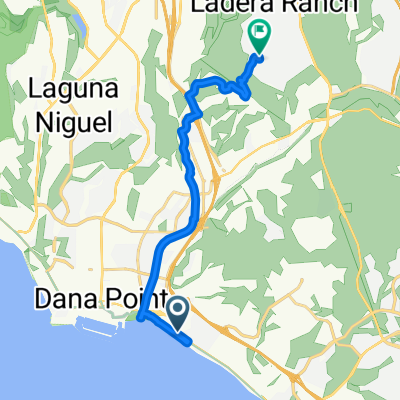
Monarch Bay Dr, Dana Point to 24721 Clarington Dr, Laguna Hills
- 17.1 km
- 198 m
- 134 m
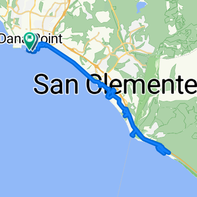
- Dana Point, California, United States
A cycling route starting in Dana Point, California, United States.
Overview
created this 3 years ago
Route quality
Cycleway
18.2 km
(94 %)
Quiet road
1 km
(5 %)
Undefined
0.2 km
(1 %)
Paved
19 km
(98 %)
Asphalt
10.6 km
(55 %)
Paved (undefined)
7.9 km
(41 %)
Continue with Bikemap
You would like to ride SJC to Dana Point or customize it for your own trip? Here is what you can do with this Bikemap route:
Free trial for 3 days, or one-time payment. More about Bikemap Premium.
Discover more Premium features.
Get Bikemap PremiumFrom our community
Open it in the app