

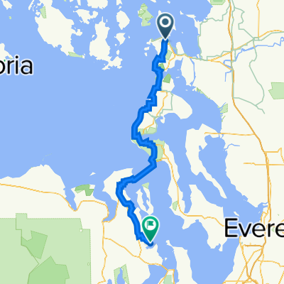
26th Street 2302, Anacortes to Giddings Road 3, Kettle Falls
A cycling route starting in Anacortes, Washington, United States.
Overview
About this route
- 37 h 2 min
- Duration
- 534.7 km
- Distance
- 10,264 m
- Ascent
- 9,937 m
- Descent
- 14.4 km/h
- Avg. speed
- 1,695 m
- Max. altitude

Route quality
Waytypes & surfaces along the route
Waytypes
Busy road
222.6 km
(42 %)
Road
211.4 km
(40 %)
Surfaces
Paved
234.6 km
(44 %)
Unpaved
11.2 km
(2 %)
Asphalt
215.9 km
(40 %)
Paved (undefined)
17.8 km
(3 %)
Continue with Bikemap
Use, edit, or download this cycling route
You would like to ride 26th Street 2302, Anacortes to Giddings Road 3, Kettle Falls or customize it for your own trip? Here is what you can do with this Bikemap route:
Free features
- Save this route as favorite or in collections
- Copy & plan your own version of this route
- Split it into stages to create a multi-day tour
- Sync your route with Garmin or Wahoo
Premium features
Free trial for 3 days, or one-time payment. More about Bikemap Premium.
- Navigate this route on iOS & Android
- Export a GPX / KML file of this route
- Create your custom printout (try it for free)
- Download this route for offline navigation
Discover more Premium features.
Get Bikemap PremiumFrom our community
Other popular routes starting in Anacortes
 therapy ride
- Distance
- 29.1 km
- Ascent
- 0 m
- Descent
- 10 m
- Location
- Anacortes, Washington, United States
 Anacortes to Port Ludlow
- Distance
- 94.7 km
- Ascent
- 1,330 m
- Descent
- 1,317 m
- Location
- Anacortes, Washington, United States
 Anacortes with loop
- Distance
- 62 km
- Ascent
- 561 m
- Descent
- 562 m
- Location
- Anacortes, Washington, United States
 Guemes Island Loop
- Distance
- 37.4 km
- Ascent
- 355 m
- Descent
- 353 m
- Location
- Anacortes, Washington, United States
 BayView-Rexville-LaConnerLoop
- Distance
- 55.9 km
- Ascent
- 188 m
- Descent
- 187 m
- Location
- Anacortes, Washington, United States
 Mount Erie Route
- Distance
- 32.8 km
- Ascent
- 669 m
- Descent
- 668 m
- Location
- Anacortes, Washington, United States
 Anacortes1
- Distance
- 65.2 km
- Ascent
- 206 m
- Descent
- 272 m
- Location
- Anacortes, Washington, United States
 March's Point Park n Ride to WA Park return
- Distance
- 31.2 km
- Ascent
- 266 m
- Descent
- 266 m
- Location
- Anacortes, Washington, United States
Open it in the app