
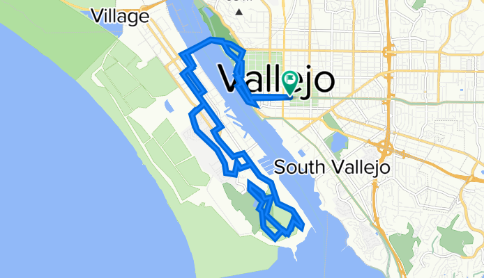
Mare Island
A cycling route starting in Vallejo, California, United States.
Overview
About this route
- -:--
- Duration
- 23.6 km
- Distance
- 219 m
- Ascent
- 221 m
- Descent
- ---
- Avg. speed
- 78 m
- Max. altitude

Continue with Bikemap
Use, edit, or download this cycling route
You would like to ride Mare Island or customize it for your own trip? Here is what you can do with this Bikemap route:
Free features
- Save this route as favorite or in collections
- Copy & plan your own version of this route
- Sync your route with Garmin or Wahoo
Premium features
Free trial for 3 days, or one-time payment. More about Bikemap Premium.
- Navigate this route on iOS & Android
- Export a GPX / KML file of this route
- Create your custom printout (try it for free)
- Download this route for offline navigation
Discover more Premium features.
Get Bikemap PremiumFrom our community
Other popular routes starting in Vallejo
 Outdoor Afro/Thompson Ride
- Distance
- 17.8 km
- Ascent
- 225 m
- Descent
- 225 m
- Location
- Vallejo, California, United States
 Monterey St, Vallejo to South Beach, San Francisco
- Distance
- 74.5 km
- Ascent
- 663 m
- Descent
- 669 m
- Location
- Vallejo, California, United States
 Mare Island from El Curtola Park & Ride chargepoint
- Distance
- 21.4 km
- Ascent
- 125 m
- Descent
- 126 m
- Location
- Vallejo, California, United States
 131 C St, Vallejo to 143 C St, Vallejo
- Distance
- 60.5 km
- Ascent
- 611 m
- Descent
- 611 m
- Location
- Vallejo, California, United States
 extended bridge loop
- Distance
- 47.5 km
- Ascent
- 416 m
- Descent
- 416 m
- Location
- Vallejo, California, United States
 Darley to Benicia
- Distance
- 11.2 km
- Ascent
- 70 m
- Descent
- 134 m
- Location
- Vallejo, California, United States
 Sulphur Springs Loop
- Distance
- 44.9 km
- Ascent
- 407 m
- Descent
- 465 m
- Location
- Vallejo, California, United States
 131 C St, Vallejo to South Beach, San Francisco
- Distance
- 97.4 km
- Ascent
- 765 m
- Descent
- 803 m
- Location
- Vallejo, California, United States
Open it in the app