

Berlin-Niederfinow-Hohenwutzen-Parstein-Eberswalde
A cycling route starting in Gesundbrunnen, State of Berlin, Germany.
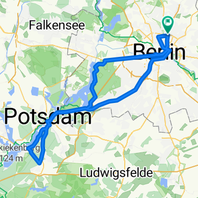
Overview
About this route
<p>Goal:</p>
<p>- on side roads or country roads in the most direct way from Berlin to the Oder, only paved paths</p>
<p></p>
<p>Path quality:</p>
<p>- Malchow to Lindenberg both sides have a good cycling path along the B2</p>
<p>- Lindenberg to Schwanebeck no cycling path, but wide lanes</p>
<p>- bad asphalt between Börnicke and Albertshof (Bernau bypass)</p>
<p>- short cobblestone section at Beerbaum</p>
<p>- bad asphalt between Oderberg and Hohensaaten (old Oder)</p>
<p>- short cobblestone section at Lake Parsteiner</p>
<p>- GPS elevation: approx. 670 m</p>
Translated, show original (German)- -:--
- Duration
- 112.5 km
- Distance
- 256 m
- Ascent
- 287 m
- Descent
- ---
- Avg. speed
- ---
- Max. altitude

Route quality
Waytypes & surfaces along the route
Waytypes
Quiet road
22.5 km
(20 %)
Road
18 km
(16 %)
Surfaces
Paved
99 km
(88 %)
Unpaved
2.2 km
(2 %)
Asphalt
97.9 km
(87 %)
Ground
2.2 km
(2 %)
Continue with Bikemap
Use, edit, or download this cycling route
You would like to ride Berlin-Niederfinow-Hohenwutzen-Parstein-Eberswalde or customize it for your own trip? Here is what you can do with this Bikemap route:
Free features
- Save this route as favorite or in collections
- Copy & plan your own version of this route
- Split it into stages to create a multi-day tour
- Sync your route with Garmin or Wahoo
Premium features
Free trial for 3 days, or one-time payment. More about Bikemap Premium.
- Navigate this route on iOS & Android
- Export a GPX / KML file of this route
- Create your custom printout (try it for free)
- Download this route for offline navigation
Discover more Premium features.
Get Bikemap PremiumFrom our community
Other popular routes starting in Gesundbrunnen
 Putbusser Straße, Berlin nach Putbusser Straße, Berlin
- Distance
- 31.1 km
- Ascent
- 541 m
- Descent
- 543 m
- Location
- Gesundbrunnen, State of Berlin, Germany
 Mauerpark > Plötzensee > Jungfernheide > HauptBhf. > Invaliedenfriedhof
- Distance
- 23.6 km
- Ascent
- 51 m
- Descent
- 50 m
- Location
- Gesundbrunnen, State of Berlin, Germany
 Prenzlauer Berg, Mühlenbeck, Blankenfelde
- Distance
- 33.8 km
- Ascent
- 44 m
- Descent
- 46 m
- Location
- Gesundbrunnen, State of Berlin, Germany
 12 Strausberg Märkische Schweiz
- Distance
- 55.5 km
- Ascent
- 83 m
- Descent
- 83 m
- Location
- Gesundbrunnen, State of Berlin, Germany
 Prenzlauer Berg <-> Wandlitz
- Distance
- 54.4 km
- Ascent
- 79 m
- Descent
- 79 m
- Location
- Gesundbrunnen, State of Berlin, Germany
 Die Eberswalde Extension 2
- Distance
- 119.3 km
- Ascent
- 342 m
- Descent
- 342 m
- Location
- Gesundbrunnen, State of Berlin, Germany
 Raus aus Berlin, anschlagen und zurück
- Distance
- 96.3 km
- Ascent
- 393 m
- Descent
- 403 m
- Location
- Gesundbrunnen, State of Berlin, Germany
 Berliner Mauerweg Nordroute
- Distance
- 48.5 km
- Ascent
- 123 m
- Descent
- 137 m
- Location
- Gesundbrunnen, State of Berlin, Germany
Open it in the app