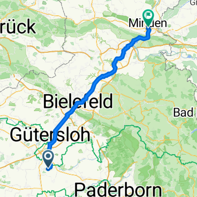
RTF Mastholte 2011
A cycling route starting in Langenberg, North Rhine-Westphalia, Germany.
Overview
About this route
- -:--
- Duration
- 82.6 km
- Distance
- 251 m
- Ascent
- 253 m
- Descent
- ---
- Avg. speed
- ---
- Max. altitude
Route quality
Waytypes & surfaces along the route
Waytypes
Quiet road
29 km
(35 %)
Busy road
22 km
(27 %)
Surfaces
Paved
64.6 km
(78 %)
Unpaved
0.5 km
(<1 %)
Asphalt
61.5 km
(74 %)
Paving stones
1.7 km
(2 %)
Continue with Bikemap
Use, edit, or download this cycling route
You would like to ride RTF Mastholte 2011 or customize it for your own trip? Here is what you can do with this Bikemap route:
Free features
- Save this route as favorite or in collections
- Copy & plan your own version of this route
- Split it into stages to create a multi-day tour
- Sync your route with Garmin or Wahoo
Premium features
Free trial for 3 days, or one-time payment. More about Bikemap Premium.
- Navigate this route on iOS & Android
- Export a GPX / KML file of this route
- Create your custom printout (try it for free)
- Download this route for offline navigation
Discover more Premium features.
Get Bikemap PremiumFrom our community
Other popular routes starting in Langenberg
- Liesborner Straße 128, Langenberg nach Im Edelkamp 8, Rheda-Wiedenbrück
- Distance
- 13.1 km
- Ascent
- 68 m
- Descent
- 94 m
- Location
- Langenberg, North Rhine-Westphalia, Germany
- Permanente RTF Mastholte-Die Flachetappe
- Distance
- 73.2 km
- Ascent
- 121 m
- Descent
- 123 m
- Location
- Langenberg, North Rhine-Westphalia, Germany
- Auf der Heide 25A, Langenberg nach Am Nordtor 1, Rietberg
- Distance
- 11 km
- Ascent
- 6 m
- Descent
- 3 m
- Location
- Langenberg, North Rhine-Westphalia, Germany
- Benteler-Wadersloh-Liesborn-Cappel-Dorf Alm-zum Freien Stuhl-Benteler
- Distance
- 38 km
- Ascent
- 93 m
- Descent
- 91 m
- Location
- Langenberg, North Rhine-Westphalia, Germany
- Landgasthof Albermann-Beckum
- Distance
- 56.3 km
- Ascent
- 306 m
- Descent
- 275 m
- Location
- Langenberg, North Rhine-Westphalia, Germany
- RTF Mastholte 2011
- Distance
- 82.6 km
- Ascent
- 251 m
- Descent
- 253 m
- Location
- Langenberg, North Rhine-Westphalia, Germany
- Tag 5 Von Mastholte nach Warendorf
- Distance
- 59.7 km
- Ascent
- 48 m
- Descent
- 75 m
- Location
- Langenberg, North Rhine-Westphalia, Germany
- R25 Langenberg
- Distance
- 14.3 km
- Ascent
- 55 m
- Descent
- 107 m
- Location
- Langenberg, North Rhine-Westphalia, Germany
Open it in the app