
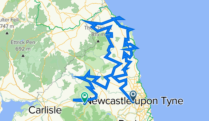
TET_UK-01-Borderlands_20220503
A cycling route starting in Newcastle upon Tyne, England, United Kingdom.
Overview
About this route
Hogwarts, Romans and Vikings - best ridden anticlockwise with a gentle intro to the UK from the port before getting tougher as it hits the Scottish border and heads south - about 30% unsealed roads - best with 2 or more riders to deal with the gates……. - aimed a middle weight trail bikes. T7 and CRF Rally - perfect, Enduros - sore bums and some tedium, GS’s - have fun in the fords
- -:--
- Duration
- 562.1 km
- Distance
- 7,155 m
- Ascent
- 6,954 m
- Descent
- ---
- Avg. speed
- 365 m
- Max. altitude

Continue with Bikemap
Use, edit, or download this cycling route
You would like to ride TET_UK-01-Borderlands_20220503 or customize it for your own trip? Here is what you can do with this Bikemap route:
Free features
- Save this route as favorite or in collections
- Copy & plan your own version of this route
- Split it into stages to create a multi-day tour
- Sync your route with Garmin or Wahoo
Premium features
Free trial for 3 days, or one-time payment. More about Bikemap Premium.
- Navigate this route on iOS & Android
- Export a GPX / KML file of this route
- Create your custom printout (try it for free)
- Download this route for offline navigation
Discover more Premium features.
Get Bikemap PremiumFrom our community
Other popular routes starting in Newcastle upon Tyne
 Westgate Road 269 to Westgate Road 269
- Distance
- 12.8 km
- Ascent
- 90 m
- Descent
- 138 m
- Location
- Newcastle upon Tyne, England, United Kingdom
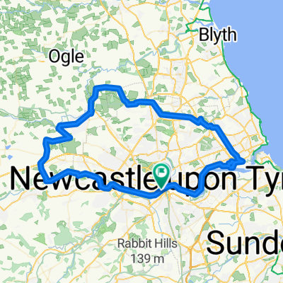
 Castles and Coast
- Distance
- 317 km
- Ascent
- 709 m
- Descent
- 652 m
- Location
- Newcastle upon Tyne, England, United Kingdom
 TET_UK-01-Borderlands_20220503
- Distance
- 562.1 km
- Ascent
- 7,155 m
- Descent
- 6,954 m
- Location
- Newcastle upon Tyne, England, United Kingdom
 Nuns Moor to Chopwell Woods
- Distance
- 17.7 km
- Ascent
- 236 m
- Descent
- 184 m
- Location
- Newcastle upon Tyne, England, United Kingdom
 NCR72 2 - Newcastle to Hexham
- Distance
- 39.4 km
- Ascent
- 305 m
- Descent
- 231 m
- Location
- Newcastle upon Tyne, England, United Kingdom
 Close, Newcastle Upon Tyne to Close, Newcastle Upon Tyne
- Distance
- 73.7 km
- Ascent
- 584 m
- Descent
- 588 m
- Location
- Newcastle upon Tyne, England, United Kingdom
 Hadrian/Wallsend 15.5KM
- Distance
- 15.8 km
- Ascent
- 72 m
- Descent
- 74 m
- Location
- Newcastle upon Tyne, England, United Kingdom
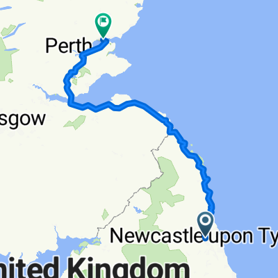 Newcastle-Dundee
- Distance
- 336 km
- Ascent
- 937 m
- Descent
- 972 m
- Location
- Newcastle upon Tyne, England, United Kingdom
Open it in the app