

Kanheri Caves, Mumbai to National Park, Mumbai
A cycling route starting in Borivali, Maharashtra, India.
Overview
About this route
- 58 min
- Duration
- 5.5 km
- Distance
- 0 m
- Ascent
- 43 m
- Descent
- 5.7 km/h
- Avg. speed
- 42 m
- Max. altitude

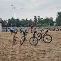
Route photos


Continue with Bikemap
Use, edit, or download this cycling route
You would like to ride Kanheri Caves, Mumbai to National Park, Mumbai or customize it for your own trip? Here is what you can do with this Bikemap route:
Free features
- Save this route as favorite or in collections
- Copy & plan your own version of this route
- Sync your route with Garmin or Wahoo
Premium features
Free trial for 3 days, or one-time payment. More about Bikemap Premium.
- Navigate this route on iOS & Android
- Export a GPX / KML file of this route
- Create your custom printout (try it for free)
- Download this route for offline navigation
Discover more Premium features.
Get Bikemap PremiumFrom our community
Other popular routes starting in Borivali
 walk
walk- Distance
- 48.3 km
- Ascent
- 61 m
- Descent
- 64 m
- Location
- Borivali, Maharashtra, India
 Mumbai to Siddharth Nagar, Mumbai
- Distance
- 3.9 km
- Ascent
- 0 m
- Descent
- 3 m
- Location
- Borivali, Maharashtra, India
 Short bike tour through Hindustan Naka
- Distance
- 2.6 km
- Ascent
- 8 m
- Descent
- 8 m
- Location
- Borivali, Maharashtra, India
 D mart, Mumbai to Shyamnarayan Thakur Road, Mumbai
- Distance
- 27.7 km
- Ascent
- 247 m
- Descent
- 247 m
- Location
- Borivali, Maharashtra, India
 Run for fun
- Distance
- 17.5 km
- Ascent
- 58 m
- Descent
- 38 m
- Location
- Borivali, Maharashtra, India
 Home to Work
- Distance
- 12.3 km
- Ascent
- 48 m
- Descent
- 45 m
- Location
- Borivali, Maharashtra, India
 NORTH-SOUTH RIDERS FIRST 200KM RIDE
- Distance
- 233.9 km
- Ascent
- 316 m
- Descent
- 315 m
- Location
- Borivali, Maharashtra, India
 29th May
- Distance
- 2.4 km
- Ascent
- 74 m
- Descent
- 72 m
- Location
- Borivali, Maharashtra, India
Open it in the app