
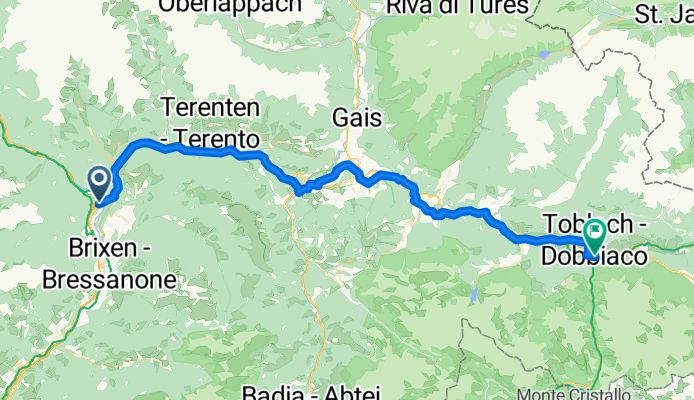
Teil 6: Pustertalradweg: Varna - Toblach
A cycling route starting in Natz-Schabs, Trentino-Alto Adige, Italy.
Overview
About this route
Wikipedia:
The RW is very well signed, with good quality of the paths. On the Niederdorf-Mühlbach section there are some climbs with gradients of up to 15%. In this section, about 500 meters of elevation need to be tackled.
- -:--
- Duration
- 60.7 km
- Distance
- 718 m
- Ascent
- 198 m
- Descent
- ---
- Avg. speed
- ---
- Max. altitude
Route quality
Waytypes & surfaces along the route
Waytypes
Quiet road
18.2 km
(30 %)
Access road
14.6 km
(24 %)
Surfaces
Paved
46.1 km
(76 %)
Unpaved
9.7 km
(16 %)
Asphalt
44.3 km
(73 %)
Gravel
4.2 km
(7 %)
Continue with Bikemap
Use, edit, or download this cycling route
You would like to ride Teil 6: Pustertalradweg: Varna - Toblach or customize it for your own trip? Here is what you can do with this Bikemap route:
Free features
- Save this route as favorite or in collections
- Copy & plan your own version of this route
- Sync your route with Garmin or Wahoo
Premium features
Free trial for 3 days, or one-time payment. More about Bikemap Premium.
- Navigate this route on iOS & Android
- Export a GPX / KML file of this route
- Create your custom printout (try it for free)
- Download this route for offline navigation
Discover more Premium features.
Get Bikemap PremiumFrom our community
Other popular routes starting in Natz-Schabs
 Tag 1 (Schabs-Prissian) 4:47
- Distance
- 68 km
- Ascent
- 505 m
- Descent
- 667 m
- Location
- Natz-Schabs, Trentino-Alto Adige, Italy
 Teil 6: Pustertalradweg: Varna - Toblach
- Distance
- 60.7 km
- Ascent
- 718 m
- Descent
- 198 m
- Location
- Natz-Schabs, Trentino-Alto Adige, Italy
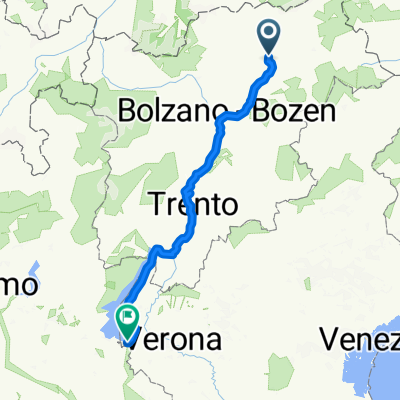
 Toblach - Bruneck - Neustift
- Distance
- 86 km
- Ascent
- 1,429 m
- Descent
- 1,646 m
- Location
- Natz-Schabs, Trentino-Alto Adige, Italy
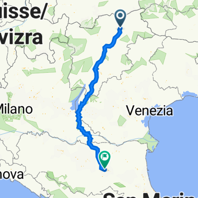
 Ciclovia del Sole - Brennero-Lago di Garda (26/06-29-06/25)
- Distance
- 220.5 km
- Ascent
- 2,102 m
- Descent
- 2,735 m
- Location
- Natz-Schabs, Trentino-Alto Adige, Italy
 Pustertaler Straße 5A, Natz-Schabs to Via Emilia Ponente 76c, Bologna
- Distance
- 370.1 km
- Ascent
- 1,783 m
- Descent
- 2,508 m
- Location
- Natz-Schabs, Trentino-Alto Adige, Italy
 KESCHTNWEG - SÜDTIROL
- Distance
- 121.2 km
- Ascent
- 3,039 m
- Descent
- 2,827 m
- Location
- Natz-Schabs, Trentino-Alto Adige, Italy
 Brenner-Franzenfeste
- Distance
- 60.8 km
- Ascent
- 1,274 m
- Descent
- 817 m
- Location
- Natz-Schabs, Trentino-Alto Adige, Italy
 von Brixen durch die Dolomiten nach Cres
- Distance
- 424.7 km
- Ascent
- 1,947 m
- Descent
- 2,651 m
- Location
- Natz-Schabs, Trentino-Alto Adige, Italy
Open it in the app