

Overview
About this route
Ridden on Thursday, June 16, 2022 Breitenbach - Traunwalchen
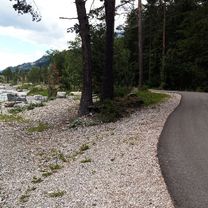
The bike path along the Inn is of very good quality. Easy cycling in nature, without unnecessary detours and climbs. From Rosenheim on bike paths, municipal network trails, and state roads through charming landscape passing Chiemsee to the destination.
- -:--
- Duration
- 110.2 km
- Distance
- 740 m
- Ascent
- 682 m
- Descent
- ---
- Avg. speed
- 574 m
- Max. altitude

Part of
10 stages
Route quality
Waytypes & surfaces along the route
Waytypes
Track
44.1 km
(40 %)
Quiet road
37.5 km
(34 %)
Surfaces
Paved
71.6 km
(65 %)
Unpaved
35.2 km
(32 %)
Asphalt
71.6 km
(65 %)
Loose gravel
22 km
(20 %)
Continue with Bikemap
Use, edit, or download this cycling route
You would like to ride Urlaub2022_6_ Chiemsee or customize it for your own trip? Here is what you can do with this Bikemap route:
Free features
- Save this route as favorite or in collections
- Copy & plan your own version of this route
- Split it into stages to create a multi-day tour
- Sync your route with Garmin or Wahoo
Premium features
Free trial for 3 days, or one-time payment. More about Bikemap Premium.
- Navigate this route on iOS & Android
- Export a GPX / KML file of this route
- Create your custom printout (try it for free)
- Download this route for offline navigation
Discover more Premium features.
Get Bikemap PremiumFrom our community
Other popular routes starting in Breitenbach am Inn
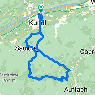
 Breitenbach Saulueg Kundler Klamm
- Distance
- 26.2 km
- Ascent
- 695 m
- Descent
- 692 m
- Location
- Breitenbach am Inn, Tyrol, Austria
 Kundl-Kaiserhaus-Buchacker-Kundl
- Distance
- 48.5 km
- Ascent
- 890 m
- Descent
- 889 m
- Location
- Breitenbach am Inn, Tyrol, Austria
 Kundl - Gramai - Pertisau - Schönau
- Distance
- 103.3 km
- Ascent
- 1,236 m
- Descent
- 1,239 m
- Location
- Breitenbach am Inn, Tyrol, Austria
 Brandenberg über Jocher
- Distance
- 29.7 km
- Ascent
- 732 m
- Descent
- 731 m
- Location
- Breitenbach am Inn, Tyrol, Austria
 Kundl-Saulueg-Thierbach-Kundl
- Distance
- 25.9 km
- Ascent
- 839 m
- Descent
- 839 m
- Location
- Breitenbach am Inn, Tyrol, Austria
 Hexenwasser Brixen
- Distance
- 54.3 km
- Ascent
- 1,060 m
- Descent
- 1,061 m
- Location
- Breitenbach am Inn, Tyrol, Austria
 Moos 71, Breitenbach am Inn nach Moos 125, Breitenbach am Inn
- Distance
- 19.9 km
- Ascent
- 18 m
- Descent
- 19 m
- Location
- Breitenbach am Inn, Tyrol, Austria
 Rofan-Reibn: Durch die Gang zur Gramai
- Distance
- 110.9 km
- Ascent
- 1,365 m
- Descent
- 1,365 m
- Location
- Breitenbach am Inn, Tyrol, Austria
Open it in the app