

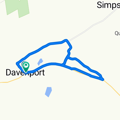
County Highway 9 580, Davenport to County Highway 9 580, Davenport
A cycling route starting in Worcester, New York, United States.
Overview
About this route
- 1 h
- Duration
- 14.5 km
- Distance
- 132 m
- Ascent
- 131 m
- Descent
- 14.4 km/h
- Avg. speed
- 423 m
- Max. altitude

Route quality
Waytypes & surfaces along the route
Waytypes
Quiet road
8.8 km
(61 %)
Road
2.3 km
(16 %)
Undefined
3.3 km
(23 %)
Surfaces
Paved
3.3 km
(23 %)
Asphalt
3.3 km
(23 %)
Undefined
11.1 km
(77 %)
Continue with Bikemap
Use, edit, or download this cycling route
You would like to ride County Highway 9 580, Davenport to County Highway 9 580, Davenport or customize it for your own trip? Here is what you can do with this Bikemap route:
Free features
- Save this route as favorite or in collections
- Copy & plan your own version of this route
- Sync your route with Garmin or Wahoo
Premium features
Free trial for 3 days, or one-time payment. More about Bikemap Premium.
- Navigate this route on iOS & Android
- Export a GPX / KML file of this route
- Create your custom printout (try it for free)
- Download this route for offline navigation
Discover more Premium features.
Get Bikemap PremiumFrom our community
Other popular routes starting in Worcester
 summit to warnerville
- Distance
- 15.7 km
- Ascent
- 160 m
- Descent
- 460 m
- Location
- Worcester, New York, United States
 Edwards roar
- Distance
- 3.6 km
- Ascent
- 105 m
- Descent
- 127 m
- Location
- Worcester, New York, United States
 New York to New York
- Distance
- 13.2 km
- Ascent
- 149 m
- Descent
- 115 m
- Location
- Worcester, New York, United States
 County Highway 9 580, Davenport to County Highway 9 580, Davenport
- Distance
- 14.5 km
- Ascent
- 132 m
- Descent
- 131 m
- Location
- Worcester, New York, United States
 New York 23 15823, Davenport to New York 23 15823, Davenport
- Distance
- 9.1 km
- Ascent
- 37 m
- Descent
- 98 m
- Location
- Worcester, New York, United States
Open it in the app