

Thüringer Wald III
A cycling route starting in Stützerbach, Thuringia, Germany.
Overview
About this route
It could have been done shorter ;-)
- -:--
- Duration
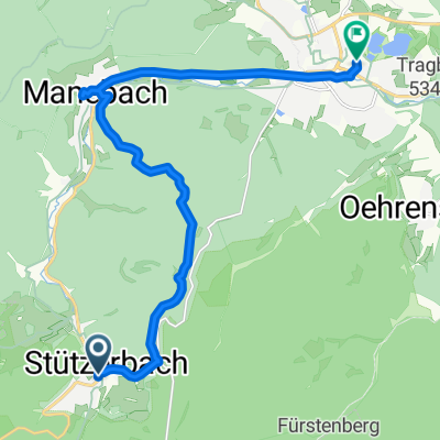
- 111.4 km
- Distance
- 1,498 m
- Ascent
- 1,498 m
- Descent
- ---
- Avg. speed
- ---
- Max. altitude

Route quality
Waytypes & surfaces along the route
Waytypes
Quiet road
14.5 km
(13 %)
Road
12.3 km
(11 %)
Surfaces
Paved
84.7 km
(76 %)
Unpaved
7.8 km
(7 %)
Asphalt
81.4 km
(73 %)
Ground
6.7 km
(6 %)
Continue with Bikemap
Use, edit, or download this cycling route
You would like to ride Thüringer Wald III or customize it for your own trip? Here is what you can do with this Bikemap route:
Free features
- Save this route as favorite or in collections
- Copy & plan your own version of this route
- Split it into stages to create a multi-day tour
- Sync your route with Garmin or Wahoo
Premium features
Free trial for 3 days, or one-time payment. More about Bikemap Premium.
- Navigate this route on iOS & Android
- Export a GPX / KML file of this route
- Create your custom printout (try it for free)
- Download this route for offline navigation
Discover more Premium features.
Get Bikemap PremiumFrom our community
Other popular routes starting in Stützerbach
 Ilmenau - Griesheim - Rottenbach ab Meyersgrund
- Distance
- 65.5 km
- Ascent
- 532 m
- Descent
- 522 m
- Location
- Stützerbach, Thuringia, Germany
 Thüringenrundfahrt Teil 3
- Distance
- 55 km
- Ascent
- 708 m
- Descent
- 699 m
- Location
- Stützerbach, Thuringia, Germany
 Stützerbach-Auerhahn-Dreiherrenstein-Allzunah-Bhf-Rennsteig
- Distance
- 14.1 km
- Ascent
- 263 m
- Descent
- 259 m
- Location
- Stützerbach, Thuringia, Germany
 080908_ FeierabendTour Rennsteig
- Distance
- 19.6 km
- Ascent
- 211 m
- Descent
- 525 m
- Location
- Stützerbach, Thuringia, Germany
 Hammeranstiege am Rennsteig (vsn. 2) Teil 3: Schmücke und Beerberg und dann die Rosenkopfstraße runter nach Suhl und heim
- Distance
- 36.9 km
- Ascent
- 614 m
- Descent
- 838 m
- Location
- Stützerbach, Thuringia, Germany
 Aadorf - Berlin 6
- Distance
- 100.5 km
- Ascent
- 302 m
- Descent
- 711 m
- Location
- Stützerbach, Thuringia, Germany
 Ilmtalradweg
- Distance
- 19.6 km
- Ascent
- 95 m
- Descent
- 289 m
- Location
- Stützerbach, Thuringia, Germany
 Maennertag 2016 Kickelhahn
- Distance
- 13.5 km
- Ascent
- 366 m
- Descent
- 515 m
- Location
- Stützerbach, Thuringia, Germany
Open it in the app