
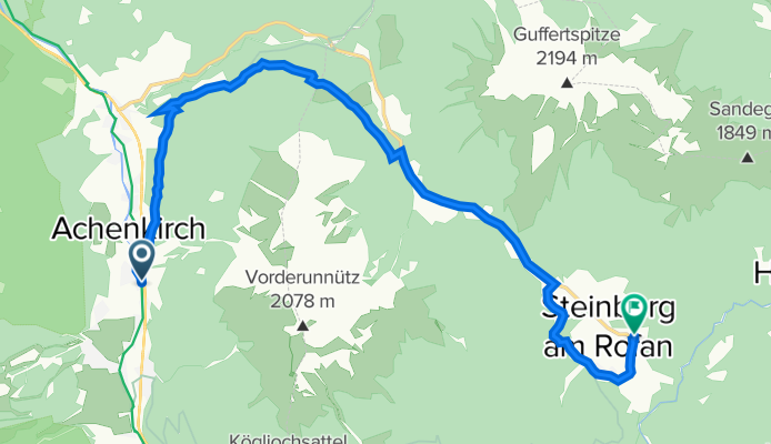
Obere Dorfstraße 233, Achenkirch nach Steinberg am Rofan 2, Steinberg am Rofan
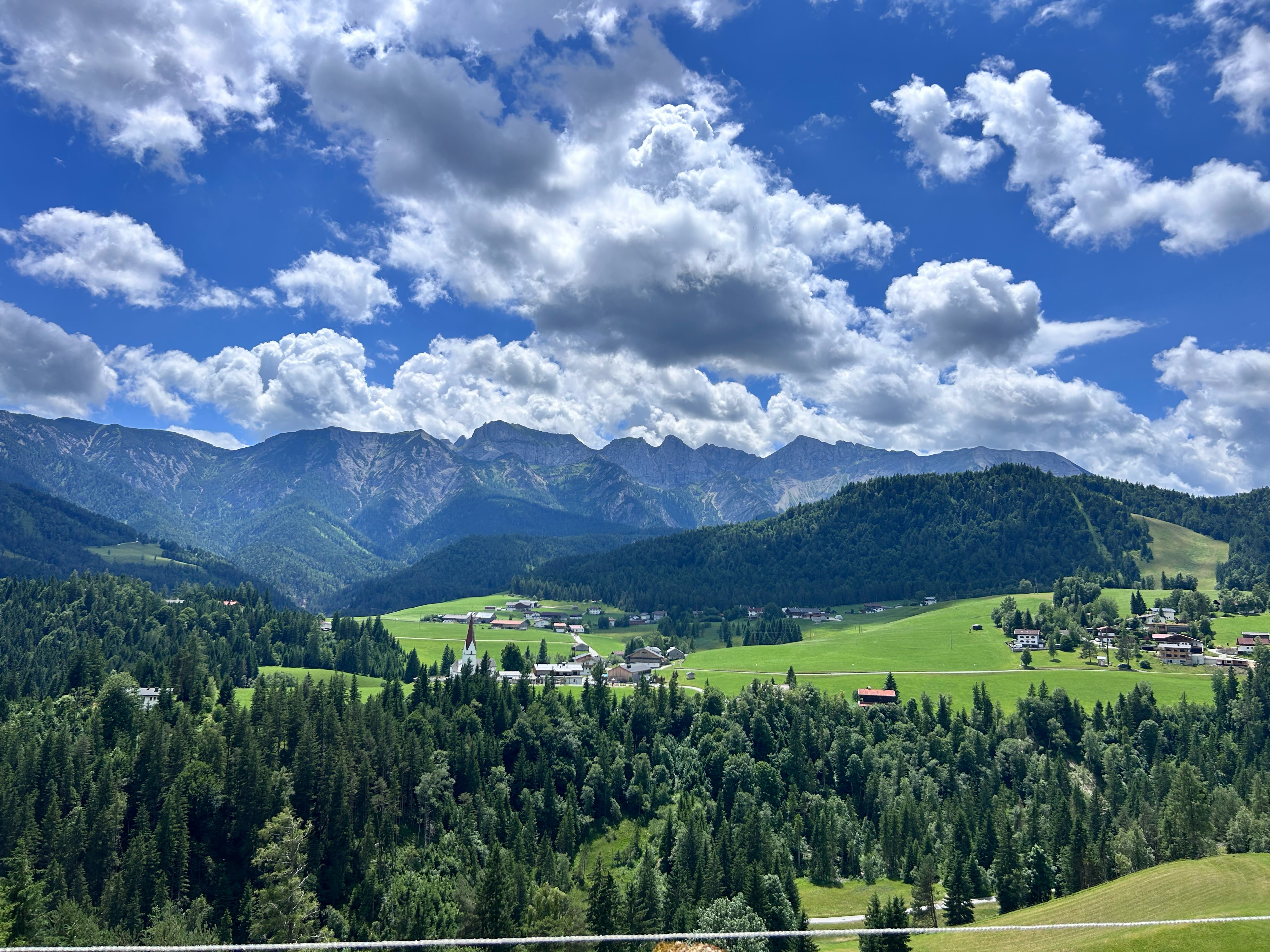
A cycling route starting in Achenkirch, Tyrol, Austria.
Overview
About this route
- 51 min
- Duration
- 13.4 km
- Distance
- 571 m
- Ascent
- 485 m
- Descent
- 15.8 km/h
- Avg. speed
- 1,076 m
- Avg. speed
Route quality
Waytypes & surfaces along the route
Waytypes
Track
8 km
(60 %)
Road
2.6 km
(20 %)
Surfaces
Paved
3.3 km
(25 %)
Unpaved
8.1 km
(60 %)
Gravel
6.9 km
(52 %)
Asphalt
3.3 km
(25 %)
Continue with Bikemap
Use, edit, or download this cycling route
You would like to ride Obere Dorfstraße 233, Achenkirch nach Steinberg am Rofan 2, Steinberg am Rofan or customize it for your own trip? Here is what you can do with this Bikemap route:
Free features
- Save this route as favorite or in collections
- Copy & plan your own version of this route
- Sync your route with Garmin or Wahoo
Premium features
Free trial for 3 days, or one-time payment. More about Bikemap Premium.
- Navigate this route on iOS & Android
- Export a GPX / KML file of this route
- Create your custom printout (try it for free)
- Download this route for offline navigation
Discover more Premium features.
Get Bikemap PremiumFrom our community
Other popular routes starting in Achenkirch
 Seewaldhütte
- Distance
- 10.9 km
- Ascent
- 507 m
- Descent
- 505 m
- Location
- Achenkirch, Tyrol, Austria
 Sylvenstein - Juifen
- Distance
- 45.2 km
- Ascent
- 1,265 m
- Descent
- 1,274 m
- Location
- Achenkirch, Tyrol, Austria
 Achenseestraße, Achenkirch nach Achenseestraße, Achenkirch
- Distance
- 49.2 km
- Ascent
- 1,323 m
- Descent
- 1,320 m
- Location
- Achenkirch, Tyrol, Austria
 große Steinbergrunde
- Distance
- 22.9 km
- Ascent
- 606 m
- Descent
- 558 m
- Location
- Achenkirch, Tyrol, Austria
 Walchensee
- Distance
- 47.3 km
- Ascent
- 611 m
- Descent
- 689 m
- Location
- Achenkirch, Tyrol, Austria
 Route 454 zu Falkenhütte, Rückweg über Ladierertal
- Distance
- 28.8 km
- Ascent
- 965 m
- Descent
- 965 m
- Location
- Achenkirch, Tyrol, Austria
 Achenkirch - Gern Alm
- Distance
- 21.5 km
- Ascent
- 334 m
- Descent
- 108 m
- Location
- Achenkirch, Tyrol, Austria
 Achensee und Naturschutzgebiet Karwendel
- Distance
- 19.1 km
- Ascent
- 418 m
- Descent
- 260 m
- Location
- Achenkirch, Tyrol, Austria
Open it in the app