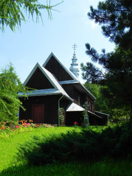
Folusz-Wątkowa
A cycling route starting in Dębica, Subcarpathian Voivodeship, Poland.
Overview
About this route
- -:--
- Duration
- 200.7 km
- Distance
- 587 m
- Ascent
- 587 m
- Descent
- ---
- Avg. speed
- ---
- Max. altitude
Route highlights
Points of interest along the route

Point of interest after 62 km
"Okienko"

Point of interest after 67.4 km
Cmentarz wojenny nr 12 Cieklin-Dobrynia

Point of interest after 71.8 km
Cmentarz wojenny nr 14

Point of interest after 74 km
Muzeum Narciarstwa
Point of interest after 77.1 km
Tutaj spotykam kolarza jadącego do Gdańska wschodnią granicą

Point of interest after 78.1 km
Cmentarz wojenny nr 11 Wola Cieklińska

Point of interest after 79.8 km
Cerkwisko

Point of interest after 84.9 km
Cerkiew w Bednarce

Point of interest after 90.6 km
Szyby naftowe

Point of interest after 92.9 km
Cerkiew w Rozdziele murowana

Point of interest after 94.4 km
Cerkiew w Rozdziele drewniana

Point of interest after 96.7 km
Cerkiew w Męcinie Wielkiej

Point of interest after 99.2 km
Rezygnuje z podejścia

Point of interest after 114.4 km
Potok Kłopotnica

Point of interest after 115 km
Bród leśny

Point of interest after 115.5 km
Skałki
Point of interest after 118.7 km
Łowisko pstrąga

Point of interest after 124.4 km
Wodospad Magurski

Point of interest after 126.5 km
Szyby naftowe

Point of interest after 197.1 km
Dębica we mgle
Continue with Bikemap
Use, edit, or download this cycling route
You would like to ride Folusz-Wątkowa or customize it for your own trip? Here is what you can do with this Bikemap route:
Free features
- Save this route as favorite or in collections
- Copy & plan your own version of this route
- Split it into stages to create a multi-day tour
- Sync your route with Garmin or Wahoo
Premium features
Free trial for 3 days, or one-time payment. More about Bikemap Premium.
- Navigate this route on iOS & Android
- Export a GPX / KML file of this route
- Create your custom printout (try it for free)
- Download this route for offline navigation
Discover more Premium features.
Get Bikemap PremiumFrom our community
Other popular routes starting in Dębica
 Rezerwat "Torfy"- Stawy Lipiński i Machowski
- Distance
- 37.6 km
- Ascent
- 117 m
- Descent
- 117 m
- Location
- Dębica, Subcarpathian Voivodeship, Poland
 2019 Pod Jasło: kurhany, zamek i panoramy
- Distance
- 120.2 km
- Ascent
- 1,016 m
- Descent
- 1,020 m
- Location
- Dębica, Subcarpathian Voivodeship, Poland
 Folusz-Wątkowa
- Distance
- 200.7 km
- Ascent
- 587 m
- Descent
- 587 m
- Location
- Dębica, Subcarpathian Voivodeship, Poland
 Magurska Odznaka Terenowa dzień 1
- Distance
- 144.8 km
- Ascent
- 1,019 m
- Descent
- 791 m
- Location
- Dębica, Subcarpathian Voivodeship, Poland
 Góra Chełm-schrony kolejowe w Stępinie i Strzyżowie
- Distance
- 106.1 km
- Ascent
- 793 m
- Descent
- 793 m
- Location
- Dębica, Subcarpathian Voivodeship, Poland
 2019.08.23 Gród w Stobiernej- Smarżowa
- Distance
- 59.4 km
- Ascent
- 539 m
- Descent
- 539 m
- Location
- Dębica, Subcarpathian Voivodeship, Poland
 2020 Pogórze Strzyżowskie: Pasmem Klonowej Góry i przez Wiśniową
- Distance
- 109.5 km
- Ascent
- 1,528 m
- Descent
- 1,529 m
- Location
- Dębica, Subcarpathian Voivodeship, Poland
 Głobikowa 26.02.12
- Distance
- 32.7 km
- Ascent
- 334 m
- Descent
- 334 m
- Location
- Dębica, Subcarpathian Voivodeship, Poland
Open it in the app


