
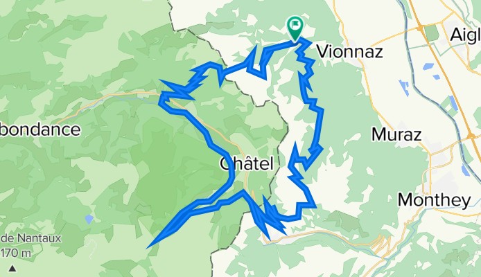
Les Portes du Soleil en gravel
A cycling route starting in Vionnaz, Valais, Switzerland.
Overview
About this route
- -:--
- Duration
- 54.4 km
- Distance
- 1,681 m
- Ascent
- 1,672 m
- Descent
- ---
- Avg. speed
- 1,776 m
- Max. altitude

Continue with Bikemap
Use, edit, or download this cycling route
You would like to ride Les Portes du Soleil en gravel or customize it for your own trip? Here is what you can do with this Bikemap route:
Free features
- Save this route as favorite or in collections
- Copy & plan your own version of this route
- Sync your route with Garmin or Wahoo
Premium features
Free trial for 3 days, or one-time payment. More about Bikemap Premium.
- Navigate this route on iOS & Android
- Export a GPX / KML file of this route
- Create your custom printout (try it for free)
- Download this route for offline navigation
Discover more Premium features.
Get Bikemap PremiumFrom our community
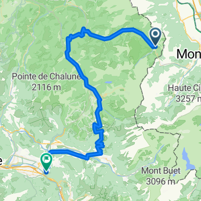
Other popular routes starting in Vionnaz
 2019_Francia_2_Châtel-La Clusaz
- Distance
- 130.3 km
- Ascent
- 2,355 m
- Descent
- 2,461 m
- Location
- Vionnaz, Valais, Switzerland
 Sanetsch from UCI without Col de la Croix
- Distance
- 121.2 km
- Ascent
- 2,157 m
- Descent
- 2,156 m
- Location
- Vionnaz, Valais, Switzerland
 Col de Bassachaux
- Distance
- 13.3 km
- Ascent
- 667 m
- Descent
- 140 m
- Location
- Vionnaz, Valais, Switzerland
 Chatel-Oyonnaz
- Distance
- 196.7 km
- Ascent
- 1,909 m
- Descent
- 2,561 m
- Location
- Vionnaz, Valais, Switzerland
 Les Portes du Soleil en gravel
- Distance
- 54.4 km
- Ascent
- 1,681 m
- Descent
- 1,672 m
- Location
- Vionnaz, Valais, Switzerland
 Muraz (Collombey) to Route de Savolar, Muraz (Collombey)
- Distance
- 0.7 km
- Ascent
- 0 m
- Descent
- 3 m
- Location
- Vionnaz, Valais, Switzerland
 2019_Francia_2_Chàtel-Le Grand-Bornand
- Distance
- 121.7 km
- Ascent
- 2,359 m
- Descent
- 2,621 m
- Location
- Vionnaz, Valais, Switzerland
 Châtel - Cluses
- Distance
- 77.6 km
- Ascent
- 2,029 m
- Descent
- 2,722 m
- Location
- Vionnaz, Valais, Switzerland
Open it in the app