

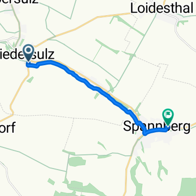
Matzen-Raggendorf nach Sebastianigasse 1, Spannberg
A cycling route starting in Hohenruppersdorf, Lower Austria, Austria.
Overview
About this route
- 39 min
- Duration
- 12.9 km
- Distance
- 120 m
- Ascent
- 181 m
- Descent
- 19.9 km/h
- Avg. speed
- 260 m
- Max. altitude

Route quality
Waytypes & surfaces along the route
Waytypes
Quiet road
7.6 km
(59 %)
Track
2.8 km
(22 %)
Surfaces
Paved
9.8 km
(76 %)
Paved (undefined)
8.8 km
(68 %)
Asphalt
1 km
(8 %)
Undefined
3.1 km
(24 %)
Continue with Bikemap
Use, edit, or download this cycling route
You would like to ride Matzen-Raggendorf nach Sebastianigasse 1, Spannberg or customize it for your own trip? Here is what you can do with this Bikemap route:
Free features
- Save this route as favorite or in collections
- Copy & plan your own version of this route
- Sync your route with Garmin or Wahoo
Premium features
Free trial for 3 days, or one-time payment. More about Bikemap Premium.
- Navigate this route on iOS & Android
- Export a GPX / KML file of this route
- Create your custom printout (try it for free)
- Download this route for offline navigation
Discover more Premium features.
Get Bikemap PremiumFrom our community
Other popular routes starting in Hohenruppersdorf
 muskatellerweg
- Distance
- 73.8 km
- Ascent
- 346 m
- Descent
- 346 m
- Location
- Hohenruppersdorf, Lower Austria, Austria
 Extensive Sonntag Route In Niedersulz
- Distance
- 7.1 km
- Ascent
- 101 m
- Descent
- 101 m
- Location
- Hohenruppersdorf, Lower Austria, Austria
 Untere Hauptstraße, Hohenruppersdorf nach Untere Hauptstraße, Hohenruppersdorf
- Distance
- 21.6 km
- Ascent
- 167 m
- Descent
- 170 m
- Location
- Hohenruppersdorf, Lower Austria, Austria
 Niedersulz 38 nach Fürlusweg 69, Schrick
- Distance
- 10.6 km
- Ascent
- 131 m
- Descent
- 75 m
- Location
- Hohenruppersdorf, Lower Austria, Austria
 Untere Hauptstraße, Hohenruppersdorf nach Untere Hauptstraße, Hohenruppersdorf
- Distance
- 12.1 km
- Ascent
- 134 m
- Descent
- 133 m
- Location
- Hohenruppersdorf, Lower Austria, Austria
 Niedersulz 234, Niedersulz nach Niedersulz 233, Niedersulz
- Distance
- 18.3 km
- Ascent
- 137 m
- Descent
- 114 m
- Location
- Hohenruppersdorf, Lower Austria, Austria
 Niedersulz, Sulz im Weinviertel nach Sebastianigasse, Spannberg
- Distance
- 5.9 km
- Ascent
- 17 m
- Descent
- 31 m
- Location
- Hohenruppersdorf, Lower Austria, Austria
 traminerweg
- Distance
- 56 km
- Ascent
- 342 m
- Descent
- 344 m
- Location
- Hohenruppersdorf, Lower Austria, Austria
Open it in the app