

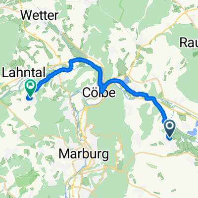
Großseelheim-Gladenbach-Göttingen
A cycling route starting in Kirchhain, Hesse, Germany.
Overview
About this route
Beautiful 3-hour tour that only runs on district, state, and federal roads.
- -:--
- Duration
- 73.4 km
- Distance
- 458 m
- Ascent
- 453 m
- Descent
- ---
- Avg. speed
- ---
- Max. altitude
Route quality
Waytypes & surfaces along the route
Waytypes
Road
23.5 km
(32 %)
Quiet road
5.9 km
(8 %)
Surfaces
Paved
53.6 km
(73 %)
Unpaved
1.5 km
(2 %)
Asphalt
52.8 km
(72 %)
Paved (undefined)
0.7 km
(1 %)
Continue with Bikemap
Use, edit, or download this cycling route
You would like to ride Großseelheim-Gladenbach-Göttingen or customize it for your own trip? Here is what you can do with this Bikemap route:
Free features
- Save this route as favorite or in collections
- Copy & plan your own version of this route
- Sync your route with Garmin or Wahoo
Premium features
Free trial for 3 days, or one-time payment. More about Bikemap Premium.
- Navigate this route on iOS & Android
- Export a GPX / KML file of this route
- Create your custom printout (try it for free)
- Download this route for offline navigation
Discover more Premium features.
Get Bikemap PremiumFrom our community
Other popular routes starting in Kirchhain
 leichtes einrollen...
- Distance
- 37.8 km
- Ascent
- 247 m
- Descent
- 247 m
- Location
- Kirchhain, Hesse, Germany
 Menhir-Tour
- Distance
- 47.6 km
- Ascent
- 437 m
- Descent
- 438 m
- Location
- Kirchhain, Hesse, Germany
 Rennstrecke-Burgwald
- Distance
- 68.1 km
- Ascent
- 244 m
- Descent
- 244 m
- Location
- Kirchhain, Hesse, Germany
 Großseelheim-Gladenbach-Göttingen
- Distance
- 73.4 km
- Ascent
- 458 m
- Descent
- 453 m
- Location
- Kirchhain, Hesse, Germany
 Einmal Quälen, und zurück...
- Distance
- 36.4 km
- Ascent
- 380 m
- Descent
- 380 m
- Location
- Kirchhain, Hesse, Germany
 Von Kirchhain bis Marburg
- Distance
- 18.7 km
- Ascent
- 193 m
- Descent
- 155 m
- Location
- Kirchhain, Hesse, Germany
 Stef@ns Deutschlandtour 07 2. Etappe vom 21.06.07 Teil 2
- Distance
- 6.9 km
- Ascent
- 33 m
- Descent
- 6 m
- Location
- Kirchhain, Hesse, Germany
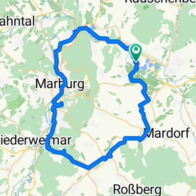 Tour Ebsdorf via Bahntrasse nach Cappel und über Cölbe zurück nach Hause
- Distance
- 48.1 km
- Ascent
- 247 m
- Descent
- 249 m
- Location
- Kirchhain, Hesse, Germany
Open it in the app