
Vogelwoog
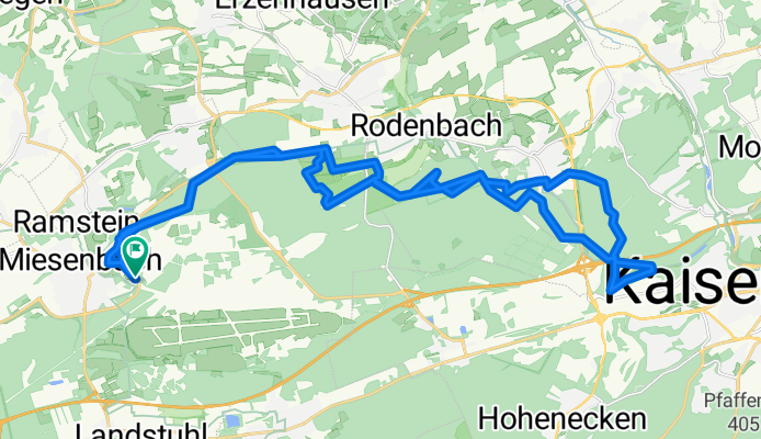
A cycling route starting in Ramstein-Miesenbach, Rhineland-Palatinate, Germany.
Overview
About this route
varied route, partly trails, but also flat sections. Smaller sections are sometimes paved, but this is rather uncommon. The Blechhammer Pond, east of Vogelwoog, is also worth seeing, a good spot for a rest
- -:--
- Duration
- 35.4 km
- Distance
- 387 m
- Ascent
- 368 m
- Descent
- ---
- Avg. speed
- 315 m
- Max. altitude
Route quality
Waytypes & surfaces along the route
Waytypes
Track
24.8 km
(70 %)
Path
6 km
(17 %)
Surfaces
Paved
6.7 km
(19 %)
Unpaved
24.4 km
(69 %)
Ground
9.6 km
(27 %)
Unpaved (undefined)
7.4 km
(21 %)
Continue with Bikemap
Use, edit, or download this cycling route
You would like to ride Vogelwoog or customize it for your own trip? Here is what you can do with this Bikemap route:
Free features
- Save this route as favorite or in collections
- Copy & plan your own version of this route
- Sync your route with Garmin or Wahoo
Premium features
Free trial for 3 days, or one-time payment. More about Bikemap Premium.
- Navigate this route on iOS & Android
- Export a GPX / KML file of this route
- Create your custom printout (try it for free)
- Download this route for offline navigation
Discover more Premium features.
Get Bikemap PremiumFrom our community
Other popular routes starting in Ramstein-Miesenbach
 Hauptstuhl_Landstuhl_Trails
- Distance
- 30.8 km
- Ascent
- 323 m
- Descent
- 323 m
- Location
- Ramstein-Miesenbach, Rhineland-Palatinate, Germany
 Potzberg Runde
- Distance
- 37.4 km
- Ascent
- 811 m
- Descent
- 812 m
- Location
- Ramstein-Miesenbach, Rhineland-Palatinate, Germany
 Wallalber Kessel
- Distance
- 58.7 km
- Ascent
- 837 m
- Descent
- 846 m
- Location
- Ramstein-Miesenbach, Rhineland-Palatinate, Germany
 Fleischhackerloch
- Distance
- 31.4 km
- Ascent
- 462 m
- Descent
- 401 m
- Location
- Ramstein-Miesenbach, Rhineland-Palatinate, Germany
 Mittelbrunner Mühle
- Distance
- 34.1 km
- Ascent
- 451 m
- Descent
- 449 m
- Location
- Ramstein-Miesenbach, Rhineland-Palatinate, Germany
 Wallalber Mühlen
- Distance
- 61.5 km
- Ascent
- 765 m
- Descent
- 756 m
- Location
- Ramstein-Miesenbach, Rhineland-Palatinate, Germany
 Elendsklamm, Fleischhackerloch
- Distance
- 42.7 km
- Ascent
- 365 m
- Descent
- 364 m
- Location
- Ramstein-Miesenbach, Rhineland-Palatinate, Germany
 Kleine Runde
- Distance
- 15.3 km
- Ascent
- 82 m
- Descent
- 82 m
- Location
- Ramstein-Miesenbach, Rhineland-Palatinate, Germany
Open it in the app