

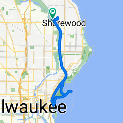
Miller Park Ride
A cycling route starting in Shorewood, Wisconsin, United States.
Overview
About this route
Miller Park Ride
- -:--
- Duration
- 15 km
- Distance
- 56 m
- Ascent
- 89 m
- Descent
- ---
- Avg. speed
- ---
- Max. altitude
Route quality
Waytypes & surfaces along the route
Waytypes
Quiet road
4.1 km
(27 %)
Busy road
3.6 km
(24 %)
Surfaces
Paved
14.3 km
(95 %)
Unpaved
0 km
(<1 %)
Asphalt
7.8 km
(52 %)
Concrete
4.1 km
(27 %)
Continue with Bikemap
Use, edit, or download this cycling route
You would like to ride Miller Park Ride or customize it for your own trip? Here is what you can do with this Bikemap route:
Free features
- Save this route as favorite or in collections
- Copy & plan your own version of this route
- Sync your route with Garmin or Wahoo
Premium features
Free trial for 3 days, or one-time payment. More about Bikemap Premium.
- Navigate this route on iOS & Android
- Export a GPX / KML file of this route
- Create your custom printout (try it for free)
- Download this route for offline navigation
Discover more Premium features.
Get Bikemap PremiumFrom our community
Other popular routes starting in Shorewood
 3581–3599 N Cramer St, Shorewood to 3563 N Cramer St, Shorewood
- Distance
- 37.4 km
- Ascent
- 165 m
- Descent
- 163 m
- Location
- Shorewood, Wisconsin, United States
 Slow ride in Zion
- Distance
- 87.6 km
- Ascent
- 204 m
- Descent
- 235 m
- Location
- Shorewood, Wisconsin, United States
 Brown Deer Rd and Back
- Distance
- 32.9 km
- Ascent
- 112 m
- Descent
- 84 m
- Location
- Shorewood, Wisconsin, United States
 Miller Park Ride
- Distance
- 15 km
- Ascent
- 56 m
- Descent
- 89 m
- Location
- Shorewood, Wisconsin, United States
 Loop
Loop- Distance
- 163.3 km
- Ascent
- 399 m
- Descent
- 399 m
- Location
- Shorewood, Wisconsin, United States
 4345–4399 N Ardmore Ave, Shorewood to 6300 W Mequon Rd, Mequon
- Distance
- 17.9 km
- Ascent
- 41 m
- Descent
- 34 m
- Location
- Shorewood, Wisconsin, United States
 Riverwest Coop Bike Class Group Ride
- Distance
- 18.5 km
- Ascent
- 118 m
- Descent
- 119 m
- Location
- Shorewood, Wisconsin, United States
 410–414 Estabrook Pkwy, Shorewood to 410–414 Estabrook Pkwy, Shorewood
- Distance
- 16.2 km
- Ascent
- 58 m
- Descent
- 41 m
- Location
- Shorewood, Wisconsin, United States
Open it in the app