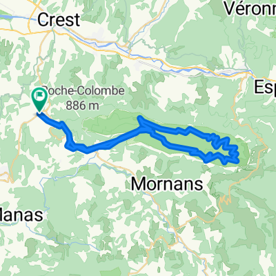
De Beaufort 脿 Beaufort sur Gervanne
A cycling route starting in Aouste-sur-Sye, Auvergne-Rh么ne-Alpes, France.
Overview
About this route
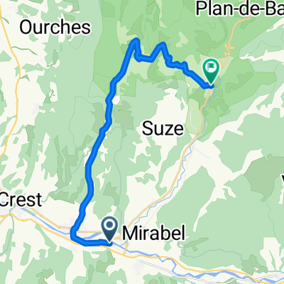
300 km loop in the Vercors massif starting from Beaufort sur Gervanne. Some cols rated R1 are on dirt tracks. The entire route is not paved.
- -:--
- Duration
- 294.7 km
- Distance
- 4,608 m
- Ascent
- 4,606 m
- Descent
- ---
- Avg. speed
- ---
- Max. altitude
Route quality
Waytypes & surfaces along the route
Waytypes
Road
103.1 km
(35 %)
Track
23.6 km
(8 %)
Surfaces
Paved
179.7 km
(61 %)
Unpaved
17.7 km
(6 %)
Asphalt
176.8 km
(60 %)
Gravel
8.8 km
(3 %)
Route highlights
Points of interest along the route
Point of interest after 12.9 km
Col de la Croix (745m)
Point of interest after 24.7 km
Col de Marignac
Point of interest after 31.3 km
Col de la Borne
Point of interest after 47.7 km
Col de Romeyer
Point of interest after 65.1 km
Col de Rousset
Point of interest after 69 km
Col de Saint Alexis
Point of interest after 85.2 km
Le collet
Point of interest after 120.5 km
Col Gaudissart
Point of interest after 124 km
Col de la Machine
Point of interest after 131.7 km
Col de Carri
Point of interest after 139.9 km
Col de Proncel
Point of interest after 146.6 km
Col de la Chau
Point of interest after 149.1 km
Col de la Chau Clapier
Point of interest after 162.4 km
Col de l'Echarasson
Point of interest after 167.9 km
Pas de la S猫re
Point of interest after 187.6 km
Col de la Croix
Point of interest after 192 km
Col du tunnel du Pionnier
Point of interest after 194.4 km
Col de la Portette
Point of interest after 195.8 km
Col de Taillebourse
Point of interest after 198.2 km
Col de la Rama
Point of interest after 202.9 km
Pas de Logue
Point of interest after 211.9 km
Pas du Gouillat (1328m)
Point of interest after 216.4 km
Pas de Chovet (R1)
Point of interest after 222.8 km
Col du Lion
Point of interest after 225.1 km
Pas du Grand Echaillon (R1)
Point of interest after 232.9 km
Col de Tourniol
Point of interest after 264.3 km
Pas de Boussi猫re
Point of interest after 266.5 km
Pas de Fr茅cou
Point of interest after 275.8 km
Col des Limouches
Point of interest after 281.9 km
Col de Bacchus
Continue with Bikemap
Use, edit, or download this cycling route
You would like to ride De Beaufort 脿 Beaufort sur Gervanne or customize it for your own trip? Here is what you can do with this Bikemap route:
Free features
- Save this route as favorite or in collections
- Copy & plan your own version of this route
- Split it into stages to create a multi-day tour
- Sync your route with Garmin or Wahoo
Premium features
Free trial for 3 days, or one-time payment. More about Bikemap Premium.
- Navigate this route on iOS & Android
- Export a GPX / KML file of this route
- Create your custom printout (try it for free)
- Download this route for offline navigation
Discover more Premium features.
Get Bikemap PremiumFrom our community
Other popular routes starting in Aouste-sur-Sye
Bourdeaux 2- Distance
- 70.8 km
- Ascent
- 1,273 m
- Descent
- 1,273 m
- Location
- Aouste-sur-Sye, Auvergne-Rh么ne-Alpes, France
Mirabel et Blacons - Camargue - Mirabel et Blacons- Distance
- 509.8 km
- Ascent
- 581 m
- Descent
- 581 m
- Location
- Aouste-sur-Sye, Auvergne-Rh么ne-Alpes, France
Col de Rousset + Combe Laval- Distance
- 147.7 km
- Ascent
- 2,900 m
- Descent
- 2,901 m
- Location
- Aouste-sur-Sye, Auvergne-Rh么ne-Alpes, France
ValDrome N 64km 1959hm- Distance
- 64.2 km
- Ascent
- 1,958 m
- Descent
- 1,958 m
- Location
- Aouste-sur-Sye, Auvergne-Rh么ne-Alpes, France
ValDrome Z 65km 1800hm- Distance
- 64.7 km
- Ascent
- 1,794 m
- Descent
- 1,798 m
- Location
- Aouste-sur-Sye, Auvergne-Rh么ne-Alpes, France
F茅lines sur Rimandoule- Distance
- 93.4 km
- Ascent
- 1,205 m
- Descent
- 1,201 m
- Location
- Aouste-sur-Sye, Auvergne-Rh么ne-Alpes, France
Saou1- Distance
- 14.9 km
- Ascent
- 404 m
- Descent
- 404 m
- Location
- Aouste-sur-Sye, Auvergne-Rh么ne-Alpes, France
Mirabel et Blacons - Pont de Barret- Distance
- 68 km
- Ascent
- 734 m
- Descent
- 720 m
- Location
- Aouste-sur-Sye, Auvergne-Rh么ne-Alpes, France
Open it in the app

