

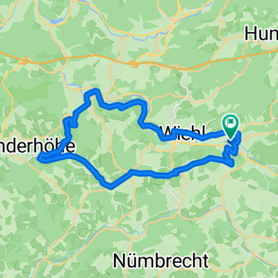
Oberwiehl-Ruppichteroth-Oberwiehl
A cycling route starting in Wiehl, North Rhine-Westphalia, Germany.
Overview
About this route
- -:--
- Duration
- 47.4 km
- Distance
- 471 m
- Ascent
- 449 m
- Descent
- ---
- Avg. speed
- ---
- Max. altitude
Route quality
Waytypes & surfaces along the route
Waytypes
Path
12.8 km
(27 %)
Quiet road
11.4 km
(24 %)
Surfaces
Paved
22.3 km
(47 %)
Unpaved
2.4 km
(5 %)
Asphalt
18.5 km
(39 %)
Paved (undefined)
3.8 km
(8 %)
Continue with Bikemap
Use, edit, or download this cycling route
You would like to ride Oberwiehl-Ruppichteroth-Oberwiehl or customize it for your own trip? Here is what you can do with this Bikemap route:
Free features
- Save this route as favorite or in collections
- Copy & plan your own version of this route
- Sync your route with Garmin or Wahoo
Premium features
Free trial for 3 days, or one-time payment. More about Bikemap Premium.
- Navigate this route on iOS & Android
- Export a GPX / KML file of this route
- Create your custom printout (try it for free)
- Download this route for offline navigation
Discover more Premium features.
Get Bikemap PremiumFrom our community
Other popular routes starting in Wiehl
 Gumm-Koln
- Distance
- 76.6 km
- Ascent
- 931 m
- Descent
- 1,049 m
- Location
- Wiehl, North Rhine-Westphalia, Germany
 Ab durch den Wald
- Distance
- 42.9 km
- Ascent
- 913 m
- Descent
- 914 m
- Location
- Wiehl, North Rhine-Westphalia, Germany
 Tour 1 Nick
- Distance
- 17.6 km
- Ascent
- 98 m
- Descent
- 143 m
- Location
- Wiehl, North Rhine-Westphalia, Germany
 Konni & Norbert Berglauf 2 Runden
- Distance
- 22.3 km
- Ascent
- 580 m
- Descent
- 583 m
- Location
- Wiehl, North Rhine-Westphalia, Germany
 Feierabend-Ründchen Oberwiehl - Oberwiehl
- Distance
- 23.7 km
- Ascent
- 304 m
- Descent
- 304 m
- Location
- Wiehl, North Rhine-Westphalia, Germany
 Marienhagener Straße 32, Wiehl nach Kirchweg 10, Wiehl
- Distance
- 14.5 km
- Ascent
- 167 m
- Descent
- 204 m
- Location
- Wiehl, North Rhine-Westphalia, Germany
 Lengthy ride from Wiehl to Engelskirchen
- Distance
- 46.8 km
- Ascent
- 671 m
- Descent
- 836 m
- Location
- Wiehl, North Rhine-Westphalia, Germany
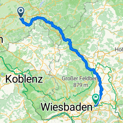 Bahnhofstraße, Wiehl nach Bethmannstraße, Frankfurt am Main
- Distance
- 198.2 km
- Ascent
- 2,499 m
- Descent
- 2,584 m
- Location
- Wiehl, North Rhine-Westphalia, Germany
Open it in the app