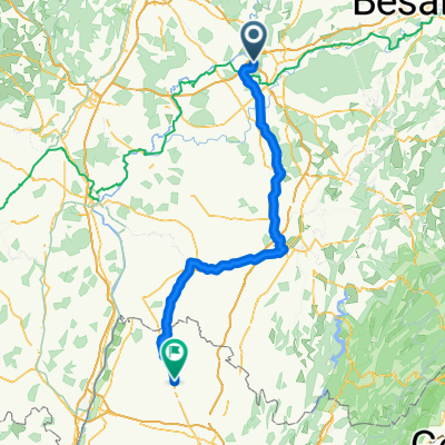
2022-04-24 10:59:38 Tag
A cycling route starting in Champvans, Bourgogne-Franche-Comté, France.
Overview
About this route
- -:--
- Duration
- 83 km
- Distance
- 186 m
- Ascent
- 197 m
- Descent
- ---
- Avg. speed
- 198 m
- Max. altitude
Route quality
Waytypes & surfaces along the route
Waytypes
Road
20.7 km
(25 %)
Quiet road
19.9 km
(24 %)
Surfaces
Paved
37.3 km
(45 %)
Unpaved
5 km
(6 %)
Asphalt
30.7 km
(37 %)
Paved (undefined)
6.6 km
(8 %)
Continue with Bikemap
Use, edit, or download this cycling route
You would like to ride 2022-04-24 10:59:38 Tag or customize it for your own trip? Here is what you can do with this Bikemap route:
Free features
- Save this route as favorite or in collections
- Copy & plan your own version of this route
- Split it into stages to create a multi-day tour
- Sync your route with Garmin or Wahoo
Premium features
Free trial for 3 days, or one-time payment. More about Bikemap Premium.
- Navigate this route on iOS & Android
- Export a GPX / KML file of this route
- Create your custom printout (try it for free)
- Download this route for offline navigation
Discover more Premium features.
Get Bikemap PremiumFrom our community
Other popular routes starting in Champvans
- Tour de Bourgogne - Etape 8 de Villers Rotin à Mâcon - 204km 200D+
- Distance
- 203.8 km
- Ascent
- 178 m
- Descent
- 198 m
- Location
- Champvans, Bourgogne-Franche-Comté, France
- C60+4_Sampans-LeVaudioux-Auberge_Bikemap_82_836
- Distance
- 82 km
- Ascent
- 836 m
- Descent
- 419 m
- Location
- Champvans, Bourgogne-Franche-Comté, France
- eddie 1
- Distance
- 65.9 km
- Ascent
- 247 m
- Descent
- 247 m
- Location
- Champvans, Bourgogne-Franche-Comté, France
- sampans foret de la serre
- Distance
- 28.7 km
- Ascent
- 370 m
- Descent
- 371 m
- Location
- Champvans, Bourgogne-Franche-Comté, France
- JOUR 13et14
- Distance
- 71.8 km
- Ascent
- 53 m
- Descent
- 78 m
- Location
- Champvans, Bourgogne-Franche-Comté, France
- B1 Dole(Nähe Saone)-Metz
- Distance
- 381.8 km
- Ascent
- 289 m
- Descent
- 321 m
- Location
- Champvans, Bourgogne-Franche-Comté, France
- 5_Saint-Seine-en-Bache-Chalon-sur-Saone
- Distance
- 83.1 km
- Ascent
- 204 m
- Descent
- 209 m
- Location
- Champvans, Bourgogne-Franche-Comté, France
- Champvans - Sennecey-le-Grand
- Distance
- 90.1 km
- Ascent
- 1,310 m
- Descent
- 1,374 m
- Location
- Champvans, Bourgogne-Franche-Comté, France
Open it in the app