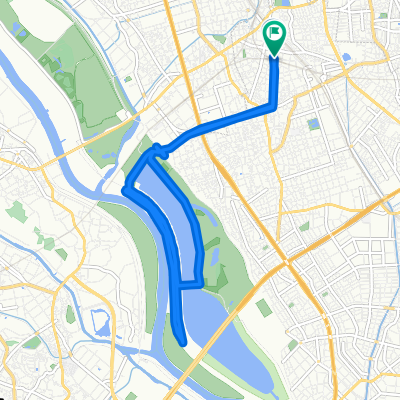
Saitama Green Healthy Road - North
A cycling route starting in Yono, Saitama, Japan.
Overview
About this route
- -:--
- Duration
- 15 km
- Distance
- 63 m
- Ascent
- 64 m
- Descent
- ---
- Avg. speed
- 15 m
- Max. altitude
Route quality
Waytypes & surfaces along the route
Waytypes
Cycleway
6.4 km
(43 %)
Quiet road
4.5 km
(30 %)
Surfaces
Paved
2.4 km
(16 %)
Asphalt
2.1 km
(14 %)
Paved (undefined)
0.3 km
(2 %)
Undefined
12.6 km
(84 %)
Continue with Bikemap
Use, edit, or download this cycling route
You would like to ride Saitama Green Healthy Road - North or customize it for your own trip? Here is what you can do with this Bikemap route:
Free features
- Save this route as favorite or in collections
- Copy & plan your own version of this route
- Sync your route with Garmin or Wahoo
Premium features
Free trial for 3 days, or one-time payment. More about Bikemap Premium.
- Navigate this route on iOS & Android
- Export a GPX / KML file of this route
- Create your custom printout (try it for free)
- Download this route for offline navigation
Discover more Premium features.
Get Bikemap PremiumFrom our community
Other popular routes starting in Yono
Saitama - Green Healthy Road 01- Distance
- 31.1 km
- Ascent
- 152 m
- Descent
- 151 m
- Location
- Yono, Saitama, Japan
Yono, Saitama <> Tama Lake- Distance
- 30.3 km
- Ascent
- 328 m
- Descent
- 233 m
- Location
- Yono, Saitama, Japan
荒川 ヘルシーロード 周回コース- Distance
- 170.9 km
- Ascent
- 35 m
- Descent
- 52 m
- Location
- Yono, Saitama, Japan
Urawa to Kawagoe Long- Distance
- 30.6 km
- Ascent
- 51 m
- Descent
- 39 m
- Location
- Yono, Saitama, Japan
Zaike, Sakura, Saitama to 413-1, Arai 2-Chōme, Kitamoto- Distance
- 22.8 km
- Ascent
- 327 m
- Descent
- 307 m
- Location
- Yono, Saitama, Japan
一人荒川いえい- Distance
- 47.5 km
- Ascent
- 125 m
- Descent
- 165 m
- Location
- Yono, Saitama, Japan
21-12, Shimoochiai 2-Chōme, Chuo, Saitama to 721, Yamata, Namegawa, Hiki-Gun- Distance
- 41.5 km
- Ascent
- 100 m
- Descent
- 45 m
- Location
- Yono, Saitama, Japan
自宅毛呂山116k- Distance
- 116.4 km
- Ascent
- 1,058 m
- Descent
- 1,057 m
- Location
- Yono, Saitama, Japan
Open it in the app


