

UBC-Queen Elizabeth Park
A cycling route starting in Vancouver, British Columbia, Canada.
Overview
About this route
- 2 h 46 min
- Duration
- 38.2 km
- Distance
- 305 m
- Ascent
- 306 m
- Descent
- 13.8 km/h
- Avg. speed
- 95 m
- Max. altitude

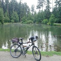
Route photos


Route quality
Waytypes & surfaces along the route
Waytypes
Quiet road
12.6 km
(33 %)
Cycleway
7.3 km
(19 %)
Surfaces
Paved
32.1 km
(84 %)
Unpaved
1.5 km
(4 %)
Asphalt
30.9 km
(81 %)
Gravel
1.5 km
(4 %)
Continue with Bikemap
Use, edit, or download this cycling route
You would like to ride UBC-Queen Elizabeth Park or customize it for your own trip? Here is what you can do with this Bikemap route:
Free features
- Save this route as favorite or in collections
- Copy & plan your own version of this route
- Sync your route with Garmin or Wahoo
Premium features
Free trial for 3 days, or one-time payment. More about Bikemap Premium.
- Navigate this route on iOS & Android
- Export a GPX / KML file of this route
- Create your custom printout (try it for free)
- Download this route for offline navigation
Discover more Premium features.
Get Bikemap PremiumFrom our community
Other popular routes starting in Vancouver
 deer lake loop
- Distance
- 17.8 km
- Ascent
- 320 m
- Descent
- 320 m
- Location
- Vancouver, British Columbia, Canada
 WE, Vancouver to Cypress XC Area
- Distance
- 71.4 km
- Ascent
- 1,722 m
- Descent
- 1,723 m
- Location
- Vancouver, British Columbia, Canada
 Seawall
- Distance
- 20.4 km
- Ascent
- 473 m
- Descent
- 475 m
- Location
- Vancouver, British Columbia, Canada
 Long bike tour through Vancouver
- Distance
- 37.2 km
- Ascent
- 428 m
- Descent
- 428 m
- Location
- Vancouver, British Columbia, Canada
 100 K Loop
- Distance
- 108.1 km
- Ascent
- 333 m
- Descent
- 335 m
- Location
- Vancouver, British Columbia, Canada
 Long bike tour from Pastviny to Vancouver
- Distance
- 36.3 km
- Ascent
- 288 m
- Descent
- 238 m
- Location
- Vancouver, British Columbia, Canada
 ride through Vancouver
- Distance
- 24.8 km
- Ascent
- 168 m
- Descent
- 168 m
- Location
- Vancouver, British Columbia, Canada
 UBC-Queen Elizabeth Park
- Distance
- 38.2 km
- Ascent
- 305 m
- Descent
- 306 m
- Location
- Vancouver, British Columbia, Canada
Open it in the app