

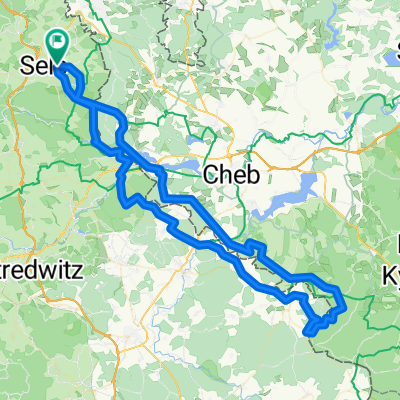
Selb-Tillenberg
A cycling route starting in Selb, Bavaria, Germany.
Overview
About this route
Day tour with several viewpoints. Some of the climbs are very steep.
- -:--
- Duration
- 92.2 km
- Distance
- 1,381 m
- Ascent
- 1,419 m
- Descent
- ---
- Avg. speed
- 933 m
- Max. altitude

Route quality
Waytypes & surfaces along the route
Waytypes
Track
57.2 km
(62 %)
Quiet road
15.7 km
(17 %)
Surfaces
Paved
38.7 km
(42 %)
Unpaved
36.9 km
(40 %)
Asphalt
34.1 km
(37 %)
Gravel
27.7 km
(30 %)
Route highlights
Points of interest along the route
Point of interest after 6.4 km
Am Ackel
Point of interest after 20.8 km
nach rechts Blick auf den Grünberg
Point of interest after 27.1 km
Überquerung der Wondrep
Point of interest after 30.5 km
weiter auf den Rot markierten Weg
Point of interest after 31 km
Die neu renovierte Wallfahrtkirche Maria Loreta
Point of interest after 40.5 km
Alternativ hier auf rot bleiben richtung Gipfel ist dann aber evtl. nicht gut fahrbar
Point of interest after 42.8 km
von rot auf grüne markierung in richtung Gipfel wechsel
Point of interest after 45.3 km
Point of interest after 46.4 km
Nach den Geologischen Mittelpunkt Europas ging es weiter zum Oberpfalzturm
Point of interest after 70.9 km
Von hier gehts weiter auf den Ostweg
Continue with Bikemap
Use, edit, or download this cycling route
You would like to ride Selb-Tillenberg or customize it for your own trip? Here is what you can do with this Bikemap route:
Free features
- Save this route as favorite or in collections
- Copy & plan your own version of this route
- Split it into stages to create a multi-day tour
- Sync your route with Garmin or Wahoo
Premium features
Free trial for 3 days, or one-time payment. More about Bikemap Premium.
- Navigate this route on iOS & Android
- Export a GPX / KML file of this route
- Create your custom printout (try it for free)
- Download this route for offline navigation
Discover more Premium features.
Get Bikemap PremiumFrom our community
Other popular routes starting in Selb
 Selb-Tillenberg
- Distance
- 92.2 km
- Ascent
- 1,381 m
- Descent
- 1,419 m
- Location
- Selb, Bavaria, Germany
 Zwischen Selb und großem Kornberg
- Distance
- 46.7 km
- Ascent
- 562 m
- Descent
- 562 m
- Location
- Selb, Bavaria, Germany
 Wellertal- Historische Grenzsteine
- Distance
- 31 km
- Ascent
- 324 m
- Descent
- 326 m
- Location
- Selb, Bavaria, Germany
 Teiche um Selb
- Distance
- 14.7 km
- Ascent
- 151 m
- Descent
- 157 m
- Location
- Selb, Bavaria, Germany
 wunsiedelrunde_rr
- Distance
- 63.1 km
- Ascent
- 433 m
- Descent
- 433 m
- Location
- Selb, Bavaria, Germany
 Franzensbader Straße 6, Selb nach Christian-Höfer-Ring 6, Selb
- Distance
- 22.3 km
- Ascent
- 336 m
- Descent
- 322 m
- Location
- Selb, Bavaria, Germany
 Elsterquellenrunde
- Distance
- 32.6 km
- Ascent
- 350 m
- Descent
- 347 m
- Location
- Selb, Bavaria, Germany
 ADFC-Wochenendausfahrt - nur Rückfahrt vom Meilerfest in Sel b
- Distance
- 39.1 km
- Ascent
- 321 m
- Descent
- 387 m
- Location
- Selb, Bavaria, Germany
Open it in the app