

De Calle Mexico 190, San Salvador Atenco a Lechería - Texcoco, San Salvador Atenco
A cycling route starting in Chiconcuac, State of Mexico, Mexico.
Overview
About this route
- 2 h 5 min
- Duration
- 33.7 km
- Distance
- 371 m
- Ascent
- 377 m
- Descent
- 16.1 km/h
- Avg. speed
- 2,490 m
- Max. altitude

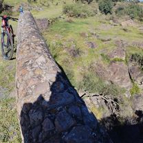
Route photos


Route quality
Waytypes & surfaces along the route
Waytypes
Busy road
20.2 km
(60 %)
Quiet road
7 km
(21 %)
Surfaces
Paved
3.1 km
(9 %)
Unpaved
0 km
(<1 %)
Asphalt
2.9 km
(9 %)
Concrete
0.2 km
(<1 %)
Continue with Bikemap
Use, edit, or download this cycling route
You would like to ride De Calle Mexico 190, San Salvador Atenco a Lechería - Texcoco, San Salvador Atenco or customize it for your own trip? Here is what you can do with this Bikemap route:
Free features
- Save this route as favorite or in collections
- Copy & plan your own version of this route
- Sync your route with Garmin or Wahoo
Premium features
Free trial for 3 days, or one-time payment. More about Bikemap Premium.
- Navigate this route on iOS & Android
- Export a GPX / KML file of this route
- Create your custom printout (try it for free)
- Download this route for offline navigation
Discover more Premium features.
Get Bikemap PremiumFrom our community
Other popular routes starting in Chiconcuac
 De Lechería - Texcoco, San Salvador Atenco a La Noria 56300, San Salvador Atenco
- Distance
- 21 km
- Ascent
- 272 m
- Descent
- 81 m
- Location
- Chiconcuac, State of Mexico, Mexico
 De Calle Juan Pablo Segundo, San Salvador Atenco a Calle Mexico 190, San Salvador Atenco
- Distance
- 29.3 km
- Ascent
- 284 m
- Descent
- 283 m
- Location
- Chiconcuac, State of Mexico, Mexico
 De Calle Mexico 190, San Salvador Atenco a Lechería - Texcoco, San Salvador Atenco
- Distance
- 28.7 km
- Ascent
- 260 m
- Descent
- 261 m
- Location
- Chiconcuac, State of Mexico, Mexico
 De La Noria 56300, San Salvador Atenco a Lechería - Texcoco, San Salvador Atenco
- Distance
- 18.7 km
- Ascent
- 92 m
- Descent
- 94 m
- Location
- Chiconcuac, State of Mexico, Mexico
 De Morelos a DE MAYO
- Distance
- 21.4 km
- Ascent
- 97 m
- Descent
- 102 m
- Location
- Chiconcuac, State of Mexico, Mexico
 De Calle Mexico 190, San Salvador Atenco a Lechería - Texcoco, San Salvador Atenco
- Distance
- 31.6 km
- Ascent
- 313 m
- Descent
- 314 m
- Location
- Chiconcuac, State of Mexico, Mexico
 De Calle Mexico 190, San Salvador Atenco a Lechería - Texcoco, San Salvador Atenco
- Distance
- 33.7 km
- Ascent
- 371 m
- Descent
- 377 m
- Location
- Chiconcuac, State of Mexico, Mexico
 De Lechería - Texcoco, San Salvador Atenco a Lechería - Texcoco, San Salvador Atenco
- Distance
- 19.9 km
- Ascent
- 115 m
- Descent
- 117 m
- Location
- Chiconcuac, State of Mexico, Mexico
Open it in the app