Nordseite des Schienerberges
A cycling route starting in Hilzingen, Baden-Wurttemberg, Germany.
Overview
About this route
A must for anyone who loves the trail on the north side of the Schinerberg. The descents to Bankholzen are made for this region.
Almost all the well-known elements of the north side of the Schienerberg are present:
- the serpentine climb from Ramsen,
- the extreme serpentine descent towards Rielasingen,
- the same climb with canyon as at the Bodensee-Megathlon, only this time with the 20% gravel section,
- the very rooty trail after crossing the L193,
- the descent to Bankholzen with the staircase element right at the end,
- the popular ascent of the L193 (to show it to the road cyclists with the bike),
- far west down to Ramsen 'The Canyon'
For an easy one, I would recommend my trail over the Heilsberg.
After a good session on the Schienerberg, you can confidently take the road to Hilzingen for a cool down.
- -:--
- Duration
- 51.6 km
- Distance
- 1,121 m
- Ascent
- 1,121 m
- Descent
- ---
- Avg. speed
- ---
- Max. altitude
Continue with Bikemap
Use, edit, or download this cycling route
You would like to ride Nordseite des Schienerberges or customize it for your own trip? Here is what you can do with this Bikemap route:
Free features
- Save this route as favorite or in collections
- Copy & plan your own version of this route
- Sync your route with Garmin or Wahoo
Premium features
Free trial for 3 days, or one-time payment. More about Bikemap Premium.
- Navigate this route on iOS & Android
- Export a GPX / KML file of this route
- Create your custom printout (try it for free)
- Download this route for offline navigation
Discover more Premium features.
Get Bikemap PremiumFrom our community
Other popular routes starting in Hilzingen
Um den Hohenstoffeln (kleine Tour)- Distance
- 16.4 km
- Ascent
- 190 m
- Descent
- 148 m
- Location
- Hilzingen, Baden-Wurttemberg, Germany
Der heilige Kral- Distance
- 63.8 km
- Ascent
- 969 m
- Descent
- 969 m
- Location
- Hilzingen, Baden-Wurttemberg, Germany
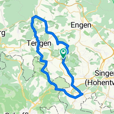
Hilzingen, Wutachtal, Schwarzwaldpanoramastraße, Klettgau, Rhein CLONED FROM ROUTE 111674- Distance
- 142.6 km
- Ascent
- 1,261 m
- Descent
- 1,261 m
- Location
- Hilzingen, Baden-Wurttemberg, Germany
Am Berg nach Kindlebildstraße- Distance
- 60.8 km
- Ascent
- 357 m
- Descent
- 473 m
- Location
- Hilzingen, Baden-Wurttemberg, Germany
Binningen - Höri - Binningen- Distance
- 67.9 km
- Ascent
- 317 m
- Descent
- 317 m
- Location
- Hilzingen, Baden-Wurttemberg, Germany
Rhein, See, Seerücken und Höri- Distance
- 104.6 km
- Ascent
- 1,143 m
- Descent
- 1,177 m
- Location
- Hilzingen, Baden-Wurttemberg, Germany
Nordseite des Schienerberges- Distance
- 51.6 km
- Ascent
- 1,121 m
- Descent
- 1,121 m
- Location
- Hilzingen, Baden-Wurttemberg, Germany
Binningen - Leipferdingen - Tengen - Bibertal - Gottmadingen - Binningen- Distance
- 47.1 km
- Ascent
- 538 m
- Descent
- 538 m
- Location
- Hilzingen, Baden-Wurttemberg, Germany
Open it in the app

