

CASA Van Isle Stage 4
A cycling route starting in Campbell River, British Columbia, Canada.
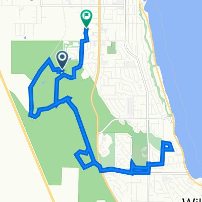
Overview
About this route
- -:--
- Duration
- 168.2 km
- Distance
- 1,561 m
- Ascent
- 1,551 m
- Descent
- ---
- Avg. speed
- 126 m
- Max. altitude

Route quality
Waytypes & surfaces along the route
Waytypes
Quiet road
21.9 km
(13 %)
Cycleway
21.9 km
(13 %)
Surfaces
Paved
141.3 km
(84 %)
Asphalt
129.5 km
(77 %)
Paved (undefined)
11.8 km
(7 %)
Undefined
26.9 km
(16 %)
Route highlights
Points of interest along the route
Point of interest after 76.6 km
Lunch Spot
Point of interest after 152 km
Support Vehicle
Point of interest after 157.9 km
Support Vehicle
Point of interest after 166.2 km
Support Vehicle Location
Continue with Bikemap
Use, edit, or download this cycling route
You would like to ride CASA Van Isle Stage 4 or customize it for your own trip? Here is what you can do with this Bikemap route:
Free features
- Save this route as favorite or in collections
- Copy & plan your own version of this route
- Split it into stages to create a multi-day tour
- Sync your route with Garmin or Wahoo
Premium features
Free trial for 3 days, or one-time payment. More about Bikemap Premium.
- Navigate this route on iOS & Android
- Export a GPX / KML file of this route
- Create your custom printout (try it for free)
- Download this route for offline navigation
Discover more Premium features.
Get Bikemap PremiumFrom our community
Other popular routes starting in Campbell River
 Day 9 of Summer 2008 Tour (Quadra Island to Cortes Island)
- Distance
- 25.3 km
- Ascent
- 276 m
- Descent
- 256 m
- Location
- Campbell River, British Columbia, Canada
 Route to 270 Stratford Dr, Campbell River
- Distance
- 15.7 km
- Ascent
- 367 m
- Descent
- 379 m
- Location
- Campbell River, British Columbia, Canada
 CASA Van Isle Stage 4
- Distance
- 168.2 km
- Ascent
- 1,561 m
- Descent
- 1,551 m
- Location
- Campbell River, British Columbia, Canada
 Blue Grouse Lake
- Distance
- 55.4 km
- Ascent
- 774 m
- Descent
- 773 m
- Location
- Campbell River, British Columbia, Canada
 Seal Bay Park
- Distance
- 84.5 km
- Ascent
- 974 m
- Descent
- 974 m
- Location
- Campbell River, British Columbia, Canada
 Spit Road 2960, Campbell River to 12 Avenue 988, Campbell River
- Distance
- 3.2 km
- Ascent
- 3 m
- Descent
- 4 m
- Location
- Campbell River, British Columbia, Canada
 CASA Van Isle Stage 4 Driving
- Distance
- 166.5 km
- Ascent
- 1,585 m
- Descent
- 1,575 m
- Location
- Campbell River, British Columbia, Canada
 Quinsam Lake Area Exploration
- Distance
- 59.5 km
- Ascent
- 835 m
- Descent
- 833 m
- Location
- Campbell River, British Columbia, Canada
Open it in the app