Almendralejo-La Fuente-Villafranca-Almendralejo
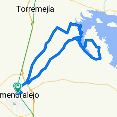
A cycling route starting in Almendralejo, Extremadura, Spain.
Overview
About this route
Ruta mixta. Si se hace en verano conviene salir temprano. tiene unos 4 kms. de asfalto. Algunas vistas impresioinantes.
- -:--
- Duration
- 46.6 km
- Distance
- 273 m
- Ascent
- 273 m
- Descent
- ---
- Avg. speed
- ---
- Avg. speed
Route quality
Waytypes & surfaces along the route
Waytypes
Track
16.4 km
(35 %)
Quiet road
13.1 km
(28 %)
Surfaces
Paved
9.7 km
(21 %)
Unpaved
13.5 km
(29 %)
Unpaved (undefined)
9 km
(19 %)
Asphalt
8.1 km
(17 %)
Continue with Bikemap
Use, edit, or download this cycling route
You would like to ride Almendralejo-La Fuente-Villafranca-Almendralejo or customize it for your own trip? Here is what you can do with this Bikemap route:
Free features
- Save this route as favorite or in collections
- Copy & plan your own version of this route
- Sync your route with Garmin or Wahoo
Premium features
Free trial for 3 days, or one-time payment. More about Bikemap Premium.
- Navigate this route on iOS & Android
- Export a GPX / KML file of this route
- Create your custom printout (try it for free)
- Download this route for offline navigation
Discover more Premium features.
Get Bikemap PremiumFrom our community
Other popular routes starting in Almendralejo
- Almendralejo-Ribera-Puebla del Prior-Almendralejo
- Distance
- 56.6 km
- Ascent
- 216 m
- Descent
- 217 m
- Location
- Almendralejo, Extremadura, Spain
- Sexmo del Limón
- Distance
- 46.2 km
- Ascent
- 236 m
- Descent
- 236 m
- Location
- Almendralejo, Extremadura, Spain
- II MARCHA NOCTURNA EN BTT
- Distance
- 93.4 km
- Ascent
- 255 m
- Descent
- 255 m
- Location
- Almendralejo, Extremadura, Spain
- ALMENDRALEJO-FUENTE DEL MAESTRE-VILLAFRANCA-ALMENDRALEJO
- Distance
- 47.2 km
- Ascent
- 219 m
- Descent
- 220 m
- Location
- Almendralejo, Extremadura, Spain
- El Manzo
- Distance
- 36.7 km
- Ascent
- 201 m
- Descent
- 190 m
- Location
- Almendralejo, Extremadura, Spain
- Pantano de Alange por el Morgaño
- Distance
- 41.5 km
- Ascent
- 197 m
- Descent
- 195 m
- Location
- Almendralejo, Extremadura, Spain
- Los Pajares
- Distance
- 32.6 km
- Ascent
- 151 m
- Descent
- 151 m
- Location
- Almendralejo, Extremadura, Spain
- Almendralejo-Mérida-Presa de Alange-Almendralejo
- Distance
- 65.4 km
- Ascent
- 218 m
- Descent
- 242 m
- Location
- Almendralejo, Extremadura, Spain
Open it in the app