

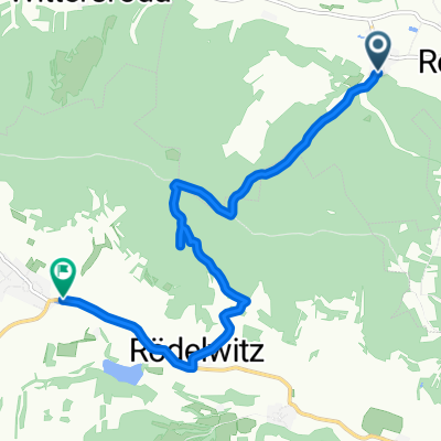
Osterfeld-Wethautal
A cycling route starting in Reinstädt, Thuringia, Germany.
Overview
About this route
berge mit gutem rad machbar, von straßenverhältnissen auch für rennrad geeignet, leichte trainingsrunde
- -:--
- Duration
- 63 km
- Distance
- 1,283 m
- Ascent
- 1,526 m
- Descent
- ---
- Avg. speed
- ---
- Max. altitude
Continue with Bikemap
Use, edit, or download this cycling route
You would like to ride Osterfeld-Wethautal or customize it for your own trip? Here is what you can do with this Bikemap route:
Free features
- Save this route as favorite or in collections
- Copy & plan your own version of this route
- Sync your route with Garmin or Wahoo
Premium features
Free trial for 3 days, or one-time payment. More about Bikemap Premium.
- Navigate this route on iOS & Android
- Export a GPX / KML file of this route
- Create your custom printout (try it for free)
- Download this route for offline navigation
Discover more Premium features.
Get Bikemap PremiumFrom our community
Other popular routes starting in Reinstädt
 Mal zum Testen
- Distance
- 43.3 km
- Ascent
- 346 m
- Descent
- 349 m
- Location
- Reinstädt, Thuringia, Germany
 Hexengrund-Triathlon Engerda -10km Runde
- Distance
- 9.3 km
- Ascent
- 117 m
- Descent
- 110 m
- Location
- Reinstädt, Thuringia, Germany
 Hexengrund-Triathlon Engerda -2,5km Runde
- Distance
- 2.3 km
- Ascent
- 40 m
- Descent
- 40 m
- Location
- Reinstädt, Thuringia, Germany
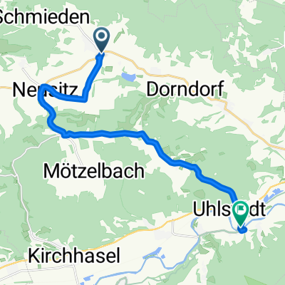
 Geunitz, Reinstädt nach K 13, Uhlstädt-Kirchhasel
- Distance
- 8.3 km
- Ascent
- 264 m
- Descent
- 243 m
- Location
- Reinstädt, Thuringia, Germany
 Hohe Straße, Eichenberg nach K 307, Magdala
- Distance
- 27.7 km
- Ascent
- 443 m
- Descent
- 582 m
- Location
- Reinstädt, Thuringia, Germany
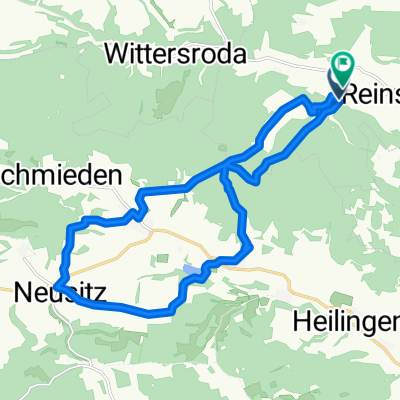 Geunitz, Reinstädt nach Geunitz, Reinstädt
- Distance
- 18.6 km
- Ascent
- 570 m
- Descent
- 569 m
- Location
- Reinstädt, Thuringia, Germany
 K 13, Uhlstädt-Kirchhasel nach Saale-Radweg, Uhlstädt-Kirchhasel
- Distance
- 13.1 km
- Ascent
- 156 m
- Descent
- 278 m
- Location
- Reinstädt, Thuringia, Germany
 Dorndorf-Arnsgereuth-Dorndorf
- Distance
- 67.3 km
- Ascent
- 892 m
- Descent
- 892 m
- Location
- Reinstädt, Thuringia, Germany
Open it in the app