Itinéraire à partir de Rue de Ronde 13, Brignais
A cycling route starting in Brignais, Auvergne-Rhône-Alpes, France.
Overview
About this route
- 1 h 52 min
- Duration
- 23.6 km
- Distance
- 608 m
- Ascent
- 612 m
- Descent
- 12.6 km/h
- Avg. speed
- 536 m
- Max. altitude
Route photos
Route quality
Waytypes & surfaces along the route
Waytypes
Quiet road
18.2 km
(77 %)
Road
2.6 km
(11 %)
Surfaces
Paved
8.7 km
(37 %)
Unpaved
0.2 km
(1 %)
Asphalt
8.7 km
(37 %)
Gravel
0.2 km
(1 %)
Undefined
14.6 km
(62 %)
Continue with Bikemap
Use, edit, or download this cycling route
You would like to ride Itinéraire à partir de Rue de Ronde 13, Brignais or customize it for your own trip? Here is what you can do with this Bikemap route:
Free features
- Save this route as favorite or in collections
- Copy & plan your own version of this route
- Sync your route with Garmin or Wahoo
Premium features
Free trial for 3 days, or one-time payment. More about Bikemap Premium.
- Navigate this route on iOS & Android
- Export a GPX / KML file of this route
- Create your custom printout (try it for free)
- Download this route for offline navigation
Discover more Premium features.
Get Bikemap PremiumFrom our community
Other popular routes starting in Brignais
- Itinéraire vers boucle sympa
- Distance
- 34.6 km
- Ascent
- 715 m
- Descent
- 718 m
- Location
- Brignais, Auvergne-Rhône-Alpes, France
- SORTIE A LYON
- Distance
- 27.7 km
- Ascent
- 235 m
- Descent
- 267 m
- Location
- Brignais, Auvergne-Rhône-Alpes, France
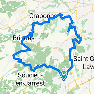
- De Avenue Ferdinand Gaillard 41, Brignais à Avenue Ferdinand Gaillard 41, Brignais dav*2 St Laurent de vaux
- Distance
- 28.6 km
- Ascent
- 1,266 m
- Descent
- 1,278 m
- Location
- Brignais, Auvergne-Rhône-Alpes, France
- Rhône 22 - Etappe 3
- Distance
- 149.2 km
- Ascent
- 581 m
- Descent
- 676 m
- Location
- Brignais, Auvergne-Rhône-Alpes, France
- De Avenue Ferdinand Gaillard 22, Brignais à Avenue Ferdinand Gaillard 41, Brignais
- Distance
- 36.1 km
- Ascent
- 795 m
- Descent
- 792 m
- Location
- Brignais, Auvergne-Rhône-Alpes, France
- Recovered Route
- Distance
- 11 km
- Ascent
- 80 m
- Descent
- 121 m
- Location
- Brignais, Auvergne-Rhône-Alpes, France
- des_Barrols_to_Tournon_97km
- Distance
- 96.4 km
- Ascent
- 99 m
- Descent
- 184 m
- Location
- Brignais, Auvergne-Rhône-Alpes, France
- BRIGNAIS
- Distance
- 20.5 km
- Ascent
- 353 m
- Descent
- 353 m
- Location
- Brignais, Auvergne-Rhône-Alpes, France
Open it in the app