

fabio 01
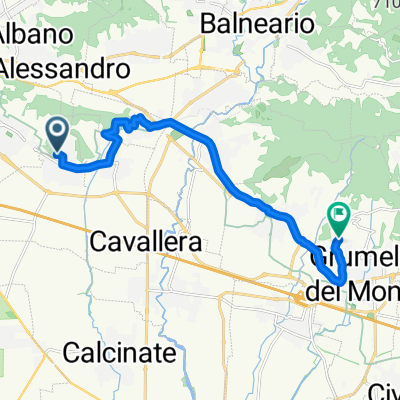
A cycling route starting in Bagnatica, Lombardy, Italy.
Overview
About this route
- -:--
- Duration
- 75 km
- Distance
- 981 m
- Ascent
- 981 m
- Descent
- ---
- Avg. speed
- ---
- Max. altitude
Route quality
Waytypes & surfaces along the route
Waytypes
Road
52.5 km
(70 %)
Quiet road
9 km
(12 %)
Surfaces
Paved
57.7 km
(77 %)
Unpaved
2.2 km
(3 %)
Asphalt
57.7 km
(77 %)
Gravel
2.2 km
(3 %)
Undefined
15 km
(20 %)
Route highlights
Points of interest along the route
Point of interest after 74.9 km
Continue with Bikemap
Use, edit, or download this cycling route
You would like to ride fabio 01 or customize it for your own trip? Here is what you can do with this Bikemap route:
Free features
- Save this route as favorite or in collections
- Copy & plan your own version of this route
- Sync your route with Garmin or Wahoo
Premium features
Free trial for 3 days, or one-time payment. More about Bikemap Premium.
- Navigate this route on iOS & Android
- Export a GPX / KML file of this route
- Create your custom printout (try it for free)
- Download this route for offline navigation
Discover more Premium features.
Get Bikemap PremiumFrom our community
Other popular routes starting in Bagnatica
 Da ?$?Ì? a ?$?Ì?
- Distance
- 13.7 km
- Ascent
- 126 m
- Descent
- 64 m
- Location
- Bagnatica, Lombardy, Italy
 La Vacherie Brusaporto => Bergamo
- Distance
- 12.5 km
- Ascent
- 77 m
- Descent
- 52 m
- Location
- Bagnatica, Lombardy, Italy
 Da Via Giovanni Pascoli, Bagnatica a Via Boccaleone 20M, Bergamo
- Distance
- 9.7 km
- Ascent
- 49 m
- Descent
- 12 m
- Location
- Bagnatica, Lombardy, Italy
 Da Via Santissimo Redentore 2–4, Bagnatica a Viale Dottor Aldo Madruzza 33, Paratico
- Distance
- 28.3 km
- Ascent
- 203 m
- Descent
- 242 m
- Location
- Bagnatica, Lombardy, Italy
 Da Via delle Groane 39, Bagnatica a Via delle Groane 39, Bagnatica
- Distance
- 53.6 km
- Ascent
- 410 m
- Descent
- 411 m
- Location
- Bagnatica, Lombardy, Italy
 fabio 01
- Distance
- 75 km
- Ascent
- 981 m
- Descent
- 981 m
- Location
- Bagnatica, Lombardy, Italy
 Da Via Don Antonio Seghezzi 1, Bagnatica a Strada Statale 573, Calcinate
- Distance
- 8.9 km
- Ascent
- 66 m
- Descent
- 99 m
- Location
- Bagnatica, Lombardy, Italy
 TRE VALLI
- Distance
- 144.8 km
- Ascent
- 1,934 m
- Descent
- 1,934 m
- Location
- Bagnatica, Lombardy, Italy
Open it in the app