

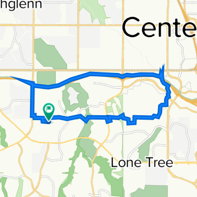
8540 S Colorado Blvd, Highlands Ranch to Mary Carter Greenway Trail, Littleton
A cycling route starting in Highlands Ranch, Colorado, United States.
Overview
About this route
- 45 min
- Duration
- 19.1 km
- Distance
- 40 m
- Ascent
- 180 m
- Descent
- 25.6 km/h
- Avg. speed
- 1,764 m
- Max. altitude

Route quality
Waytypes & surfaces along the route
Waytypes
Cycleway
19.1 km
(100 %)
Surfaces
Paved
19.1 km
(100 %)
Concrete
9.7 km
(51 %)
Paved (undefined)
5.2 km
(27 %)
Continue with Bikemap
Use, edit, or download this cycling route
You would like to ride 8540 S Colorado Blvd, Highlands Ranch to Mary Carter Greenway Trail, Littleton or customize it for your own trip? Here is what you can do with this Bikemap route:
Free features
- Save this route as favorite or in collections
- Copy & plan your own version of this route
- Sync your route with Garmin or Wahoo
Premium features
Free trial for 3 days, or one-time payment. More about Bikemap Premium.
- Navigate this route on iOS & Android
- Export a GPX / KML file of this route
- Create your custom printout (try it for free)
- Download this route for offline navigation
Discover more Premium features.
Get Bikemap PremiumFrom our community
Other popular routes starting in Highlands Ranch
 East of the house to Lone Tree
- Distance
- 14.9 km
- Ascent
- 3,715 m
- Descent
- 3,718 m
- Location
- Highlands Ranch, Colorado, United States
 Daniels Parker Kalmon Loop out and back
- Distance
- 90.5 km
- Ascent
- 689 m
- Descent
- 687 m
- Location
- Highlands Ranch, Colorado, United States
 Monarch
- Distance
- 48.1 km
- Ascent
- 893 m
- Descent
- 893 m
- Location
- Highlands Ranch, Colorado, United States
 Painted Canyon Circle 9451, Littleton to High Cliffe Place 2801, Littleton
- Distance
- 17.2 km
- Ascent
- 138 m
- Descent
- 120 m
- Location
- Highlands Ranch, Colorado, United States
 Deer Creek Long Loop
- Distance
- 71.2 km
- Ascent
- 1,093 m
- Descent
- 1,092 m
- Location
- Highlands Ranch, Colorado, United States
 South Laurel Court 9005, Littleton to Perimeter Road, Littleton
- Distance
- 9.9 km
- Ascent
- 42 m
- Descent
- 148 m
- Location
- Highlands Ranch, Colorado, United States
 Short bike tour through Highlands Ranch
- Distance
- 3.7 km
- Ascent
- 15 m
- Descent
- 66 m
- Location
- Highlands Ranch, Colorado, United States
 2000 E County Line Rd, Highlands Ranch to 1601 Wynkoop St, Denver
- Distance
- 29.2 km
- Ascent
- 67 m
- Descent
- 226 m
- Location
- Highlands Ranch, Colorado, United States
Open it in the app