
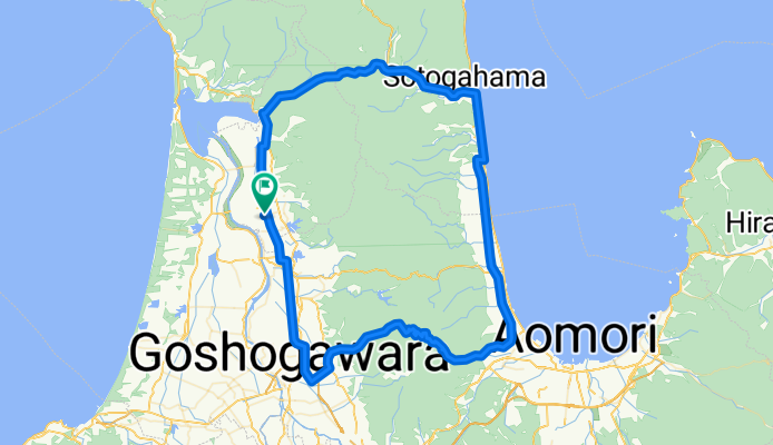
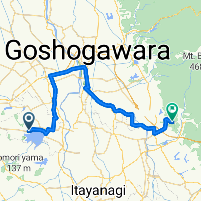
Nakasato Goshogawara Aburakawa Kanita loop
A cycling route starting in Shimokizukuri, Aomori, Japan.
Overview
About this route
A fairly easy 100 k, with a moderate 250 m climb. If going anti-clockwise expect a headwind on the coastal bit.
青森 中里
- -:--
- Duration
- 98.2 km
- Distance
- 367 m
- Ascent
- 370 m
- Descent
- ---
- Avg. speed
- ---
- Max. altitude
Route quality
Waytypes & surfaces along the route
Waytypes
Road
26.5 km
(27 %)
Quiet road
13.7 km
(14 %)
Surfaces
Paved
5.9 km
(6 %)
Paved (undefined)
5.9 km
(6 %)
Undefined
92.3 km
(94 %)
Continue with Bikemap
Use, edit, or download this cycling route
You would like to ride Nakasato Goshogawara Aburakawa Kanita loop or customize it for your own trip? Here is what you can do with this Bikemap route:
Free features
- Save this route as favorite or in collections
- Copy & plan your own version of this route
- Split it into stages to create a multi-day tour
- Sync your route with Garmin or Wahoo
Premium features
Free trial for 3 days, or one-time payment. More about Bikemap Premium.
- Navigate this route on iOS & Android
- Export a GPX / KML file of this route
- Create your custom printout (try it for free)
- Download this route for offline navigation
Discover more Premium features.
Get Bikemap PremiumFrom our community
Other popular routes starting in Shimokizukuri
 Nakasato Kuroishi Lake Towada Mt Hakoda Aomori loop
- Distance
- 205.1 km
- Ascent
- 1,695 m
- Descent
- 1,697 m
- Location
- Shimokizukuri, Aomori, Japan
 Nakasato Lake Jusan Tappi Zaki Kanita loop
- Distance
- 135 km
- Ascent
- 773 m
- Descent
- 773 m
- Location
- Shimokizukuri, Aomori, Japan
 Nakasato Ajigasawa Mt Iwaki Hirosaki Kuroishi Lake Towada Mt Hakoda Aomori
- Distance
- 257.2 km
- Ascent
- 2,011 m
- Descent
- 2,011 m
- Location
- Shimokizukuri, Aomori, Japan
 一般県道鶴田五所川原自転車道線(津軽富士見湖狼ノ長根自転車道)
- Distance
- 26.2 km
- Ascent
- 110 m
- Descent
- 36 m
- Location
- Shimokizukuri, Aomori, Japan
 rock wood to skyline
- Distance
- 25.3 km
- Ascent
- 1,229 m
- Descent
- 1,626 m
- Location
- Shimokizukuri, Aomori, Japan
 0904鯵ヶ沢町-青森市-函館市60km
- Distance
- 59.7 km
- Ascent
- 338 m
- Descent
- 380 m
- Location
- Shimokizukuri, Aomori, Japan
 Nakasato Goshogawara Aburakawa Kanita loop
- Distance
- 98.2 km
- Ascent
- 367 m
- Descent
- 370 m
- Location
- Shimokizukuri, Aomori, Japan
Open it in the app